Cycling the Niagara Peninsula
Cycling the
Niagara Peninsula Loop
(Scroll down to the bottom the this page for map and photos.)
For the better part of a decade, the Niagara Peninsula has been held out as one of the premier cycling destinations in Ontario. And for good reason – it has just about everything a touring cyclist could want. This includes excellent bicycle paths, some breathtaking scenery, a great selection of places to stop for food or accommodations, a variety of both local and world class tourist attractions, and much more.
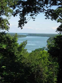
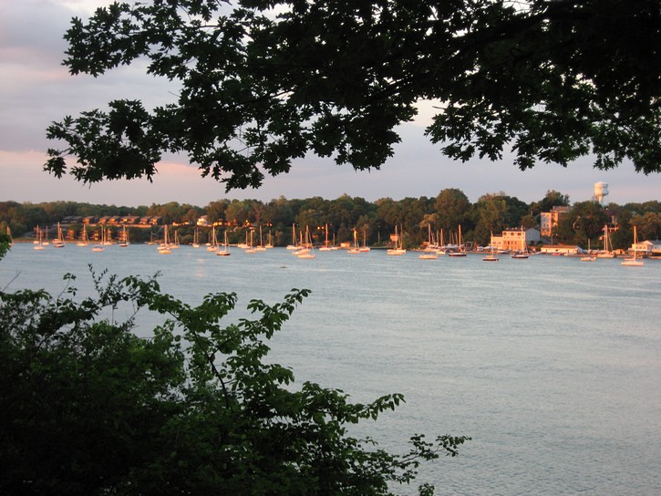
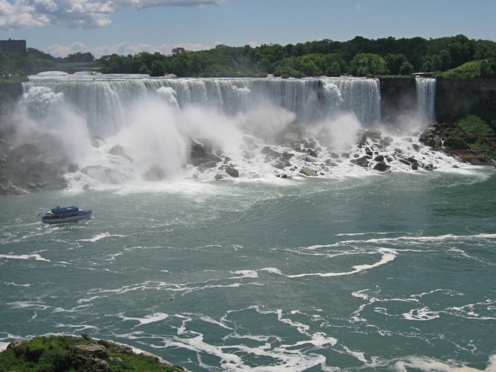
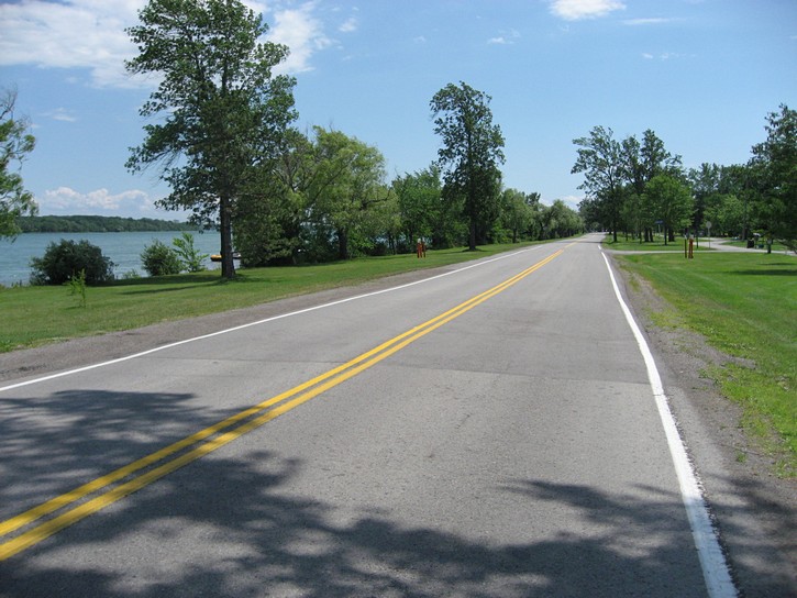
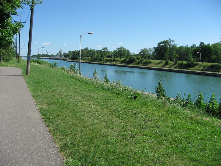
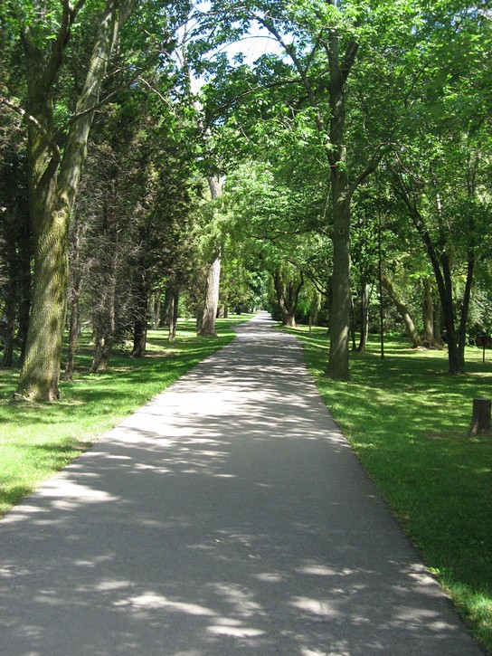
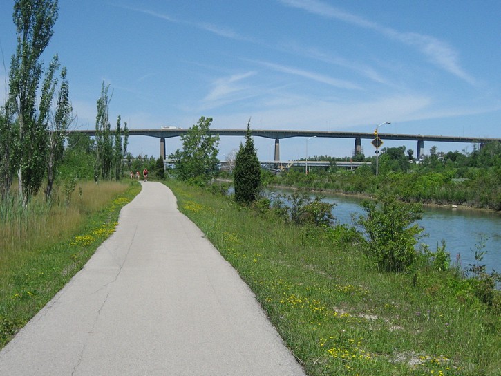
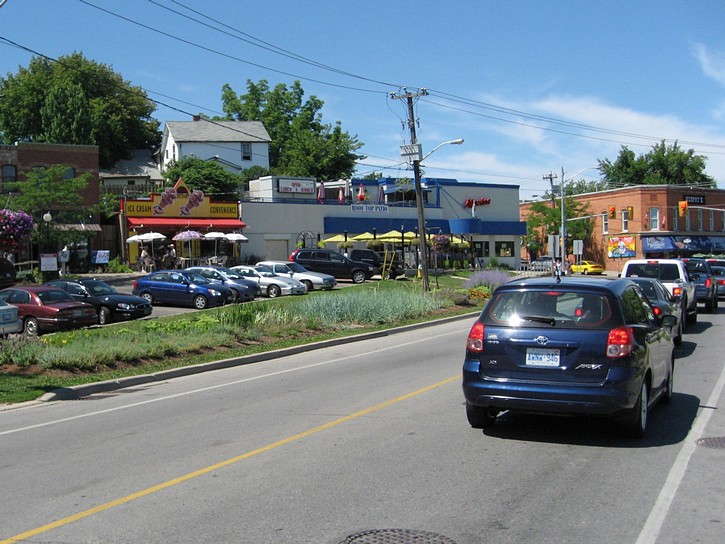
A view of the Niagara River. (scroll to the bottom for more photos)
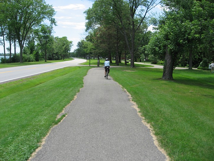
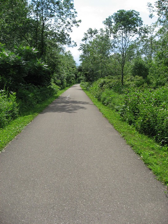
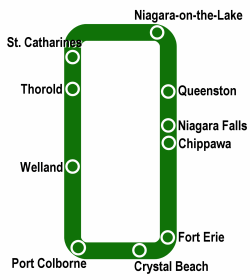
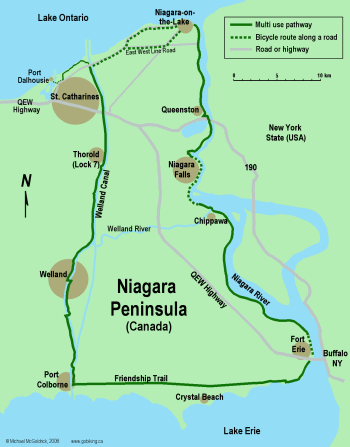
There are a good number of cycling routes which make use of roads and/or paths for riding throughout the Niagara Peninsula. However, when people are speaking of cycling in this area, they are usually referring to what is known as the “Greater Niagara Circle Route”, or simply the Niagara-Welland loop. It runs next to the Niagara River and the Welland Canal, with short segments along the shores of Lake Ontario and Lake Erie. For the most part, this route follows a wide bicycle/multi-use path that has a good paved surface. This loop covers about 140 kilometres; a little longer with a side trip to Port Dalhousie.
This route is surprisingly flat, except for a couple of hills on the actual Niagara escarpment. These hills are very localized and only represent a small percentage of the overall route. Generally, they are not that big a deal, and people who normally avoid hills should not let them become a deterrent for enjoying a great ride in the Niagara Peninsula.
Getting to the Niagara Peninsula
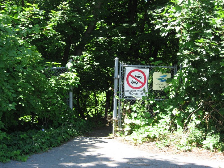
There are a number of ways of getting to the Niagara Peninsula. If you are coming from Toronto or points east, you could cycle to the area on the Ontario’s Waterfront Trail. It runs from Niagara all the way to the Quebec border. Unfortunately, this trail is still being developed, and has large sections where you will find yourself riding on very busy roads, some of which have no paved shoulder. Moreover, despite its name, many parts of the trail which are not in visual distance of the waterfront. You can expect to encounter some of these shortcomings when using this trail to cycle to the Niagara Peninsula.
One of the nicest ways of getting to the area is to take the “Bike Train” (now operated by GO Transit). It caters specifically to cyclists and runs throughout the summer between Toronto and the Niagara Peninsula. What makes this train so special is that it is equipped with bicycle racks, which means there is no need to partly disassemble and pack your bike in a box in order to check it in as luggage. In other words, when you get to your destination, your bike rolls off the train and is ready to go (see the link below for more information). It’s worth noting that the Bike Train was orginally started as a pilot project with VIA Rail in 2008 , and it was such a success that it is being expanded to other areas.
Of course, you can always put a bicycle rack on your car and drive to the Niagara Peninsula. Needless to say, this is not as environmentally friendly as cycling, but it remains one of the more practical ways of getting there. One advantage of using your car is that you will be able to pick the spot where you will start your ride on the Niagara-Welland loop.
When planning your ride, you can cycle the “Greater Niagara Circle Route” in either direction, and choose to start from any number of convenient locations on the loop (more on this later). However, for the purpose of this article, we will be doing the loop in the clockwise direction starting from Niagara-on-the-Lake.
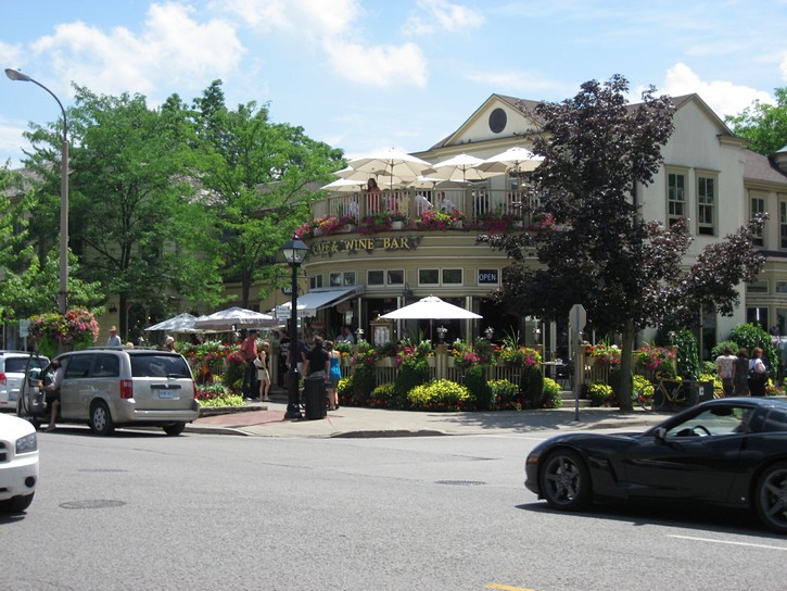
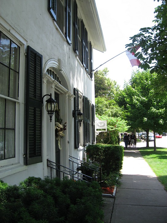
The Town of Niagara-on-the-Lake
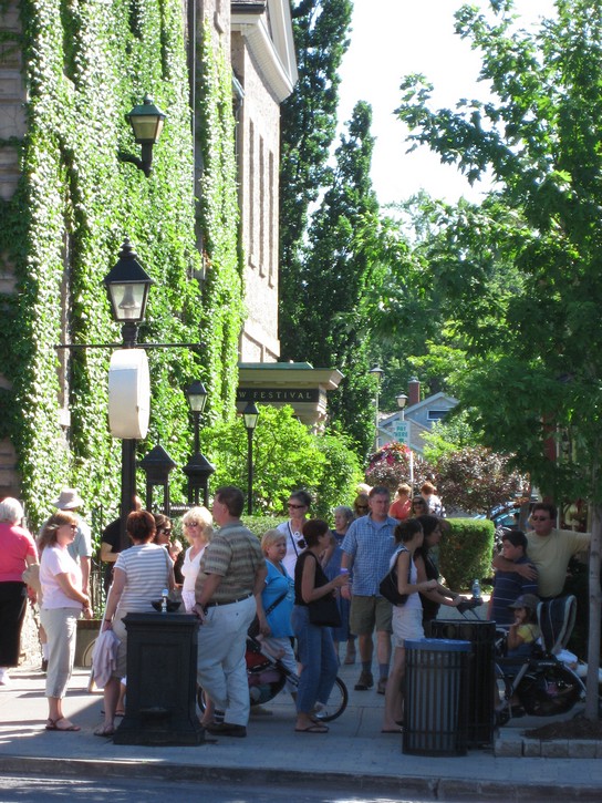
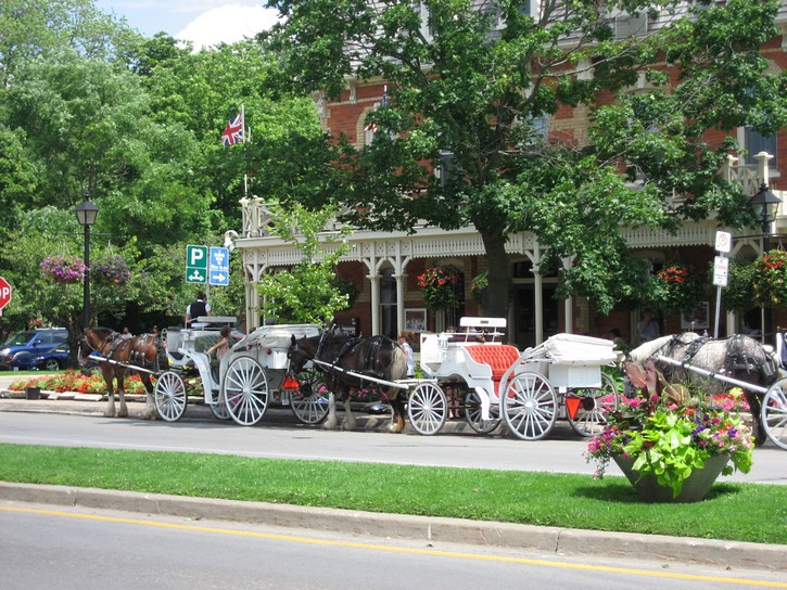
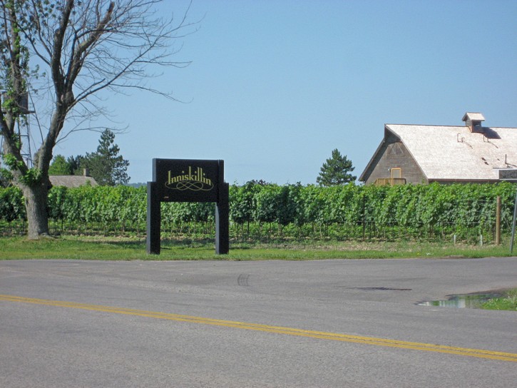
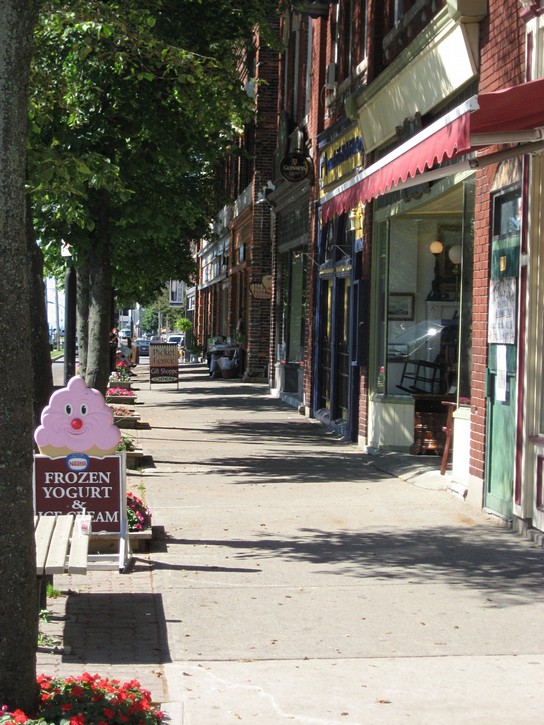
Niagara-on-the-Lake is a town with close to 15,000 people that is located on the northeast corner of the Niagara Peninsula. After the Niagara Falls, it is the region’s most popular tourist destination, and its main street oozes with small town historic charm. Here you will find wall-to-wall specialty shops, boutiques, restaurants, pubs, inns and spas. It is home of the Shaw Festival Theater and the agricultural land surrounding the town is covered almost entirely with vineyards. Needless to say, the place is jam packed with tourists on busy summer weekends.
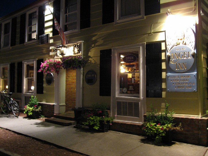
Much of Niagara-on-the-Lake’s charm is rooted in its history. It was originally established in 1792, but was rebuilt after it was destroyed by American forces in the War of 1812. Part of its downtown core is designated as a National Historic District and at one time was a candidate for recognition as a UNESCO World Heritage Site. You’ll get a sense of this history when strolling down Queen Street, the town’s main thoroughfare. You soon discover the Fort George Historic site, a restored 1869 drugstore, and the Angel Inn, which bills itself as Ontario’s “oldest operating inn”. As an added bonus, this inn has a great pub in its ground floor.
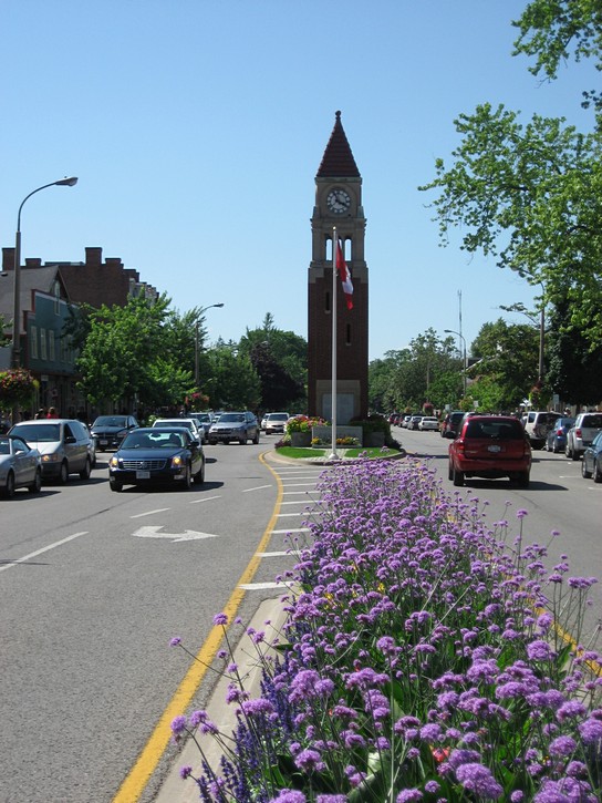
The tourist office is a good place to learn more about Niagara-on-the-Lake, although it can a little difficult to find. With a bit of looking around, you should be able to located it on the north side of Queen Street opposite the Clock Tower (this small tower is easy to spot because it is smack in the middle of Queen Street.) Be sure to ask for a copy of the cycling map for the Niagara region, although they can sometimes be stingy about handing it out. While it is nice to have this map, it’s not absolutely necessary when cycling the Niagara-Welland loop.
 A word of caution about Niagara-on-the-Lake: it can be very expensive. Some of the inns and the tourist office will unabashedly quote outrageously high prices for overnight accommodations. However, it pays to shop around because it is possible to find more reasonably priced inns and bed & breakfast in the downtown area (but these will still be on the expensive side). If you are travelling on a budget, you will not want to spend too much time here.
You will be able to find the bicycle path at the south end the downtown core. Head southeast on Queen Street into the park just past the Shaw Festival Theater, and turn left into a parking lot for the Fort George historic site. The path starts on the back side of this parking lot. There is also an information kiosk at the entrance of the parking lot where, if you haven’t done so, you may be able to pick up the aforementioned cycling map.
If you arrive in Niagara-on-the-Lake by car, you need a place to leave your vehicle when cycling. Unfortunately, the town makes absolutely no provisions for overnight parking, paid or unpaid. The solution to this dilemma is an ad-hoc arrangement which appears to exist with the parking lot for the Fort George Historic site. If you use the machine to pay your first day of parking, and leave a note on your dash indicating that you have gone cycling for a couple of days, you should be able to leave your vehicle here overnight.
It is important to note that this overnight parking arrangement seems to be an informal one that may not be in place every year. You may therefore want to clarify the situation by inquiring at the information kiosk next to the parking lot. Without this overnight parking arrangement, cyclists may have to find a less “touristy” town from which to start their ride on the Niagara-Welland loop.
From Niagara-on-the-Lake to Niagara Falls
It’s about 22 kilometres from Niagara-on-the-Lake to Niagara Falls, and this leg of the loop has most of what the region is famous for, including numerous wineries, spectacular views of the Niagara River, and a succession of historic sites and other attractions. In fact, by comparison, the rest of the Niagara-Welland loop may seem a little anticlimactic.
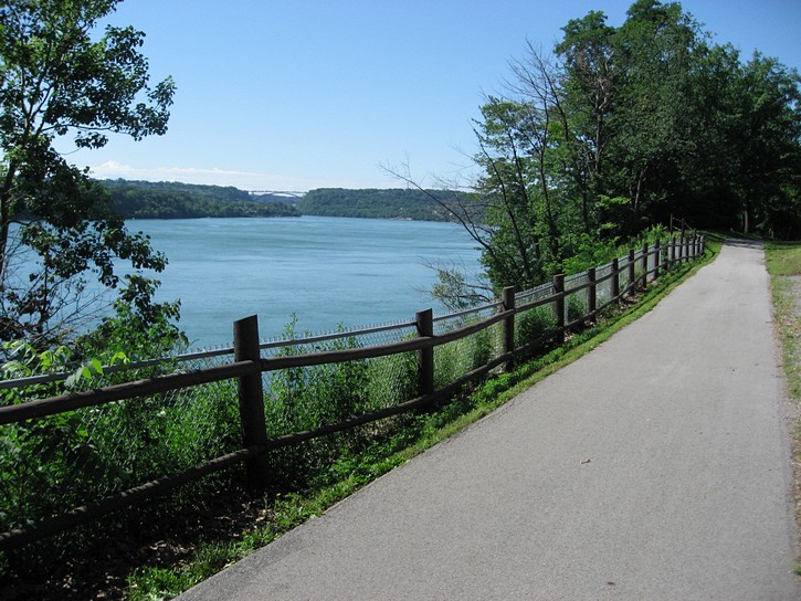
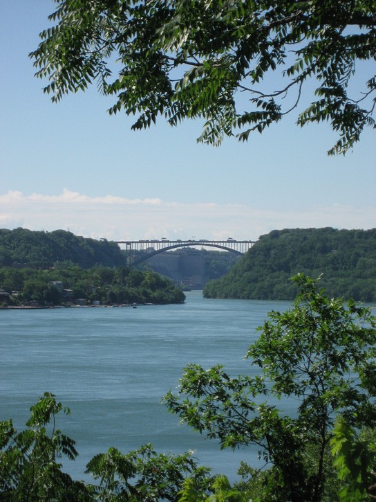
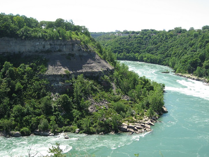
During this portion of your ride, you will be cycling along the Niagara River which flows in a relatively deep gorge. The view of the river is sometimes obscured by a thin line of trees, but there are still lots of spot where you see the surrounding landscape. There also seems to be historic plaques every kilometre along this section of the pathway. If you stop to enjoy half the vistas, or to read just a portion of the historical plaques, you can expect the time it takes to cycle this leg to be two to three times longer than normal.
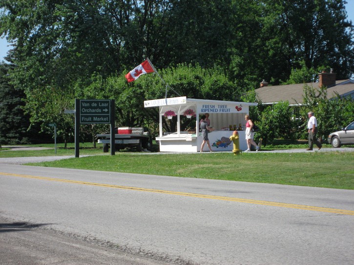
On your right side will be the Parkway and a series of wineries, some of which are quite large. A few offer tours of their vineyards and facilities, and almost all will provide opportunities to taste and purchase their wines. Depending on the time of year, you’ll also come across a number of roadside stalls and outlets on the parkway which sell fresh fruits and vegetables.
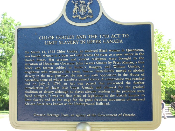
At about the half way mark of this leg of the ride, you will pass through the small town of Queenston. Here the bicycle path brings you onto one of the town’s very quiet streets. You’ll descend a hill going into town, and have to climb the corresponding height when leaving. You will also encounter another hill shortly after Queenston, but this will be the most serious climbing you’ll have to do when riding the Niagara-Welland loop in a clockwise direction.
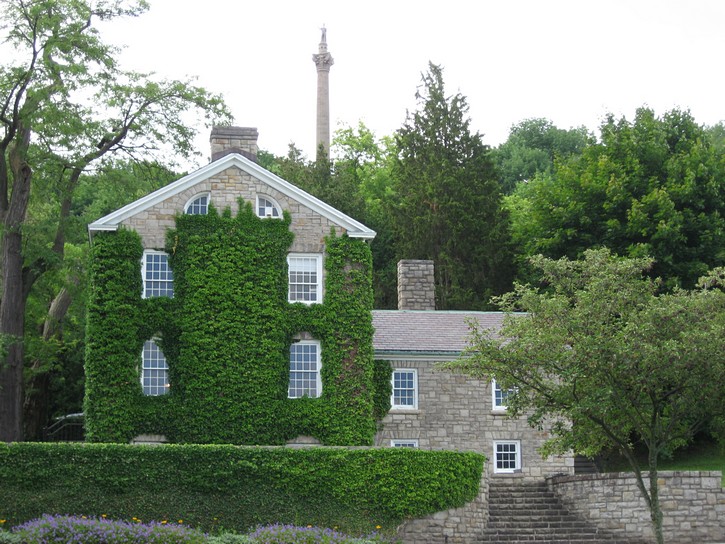
In Queenston you will come across the Printery & Newspaper Museum, which describes itself as the “best hands-on museum in Upper Canada”. You will also ride by a small park which features a bronze statue of Major-General Brock’s horse that is enclosed in a glass case. With all the references to this statue in the tourist brochures, it seems disappointingly small. And if you haven’t already done so, you are bound to notice the 185 foot high “Brock’s Monument”, a structure which seems to dominate the landscape around Queenston.
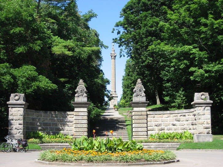
Historical Monuments at Queenston
After Queenston, the path takes a few twists and turns, and you end up at the base of a long staircase which leads to Brock’s Monument, the tallest monument ever erected for a British soldier. This monument and surrounding area commemorates an important battle which took place during the War of 1812 when, under the command of Major-General Brock, British Regulars, Canadian Militia, and their Aboriginal Allies, successfully repelled a major attack by American forces. The outcome of this battle may well have determined whether Canada was to become part of the United States or an independent country.
If you do go up the stairs, you will also come across a monument to Laura Secord, which commemorates her role in warning the British of American plans for a surprise attack during the War of 1812. Behind this monument is one of the best views of the Niagara River as it carves its way through the Niagara escarpment.
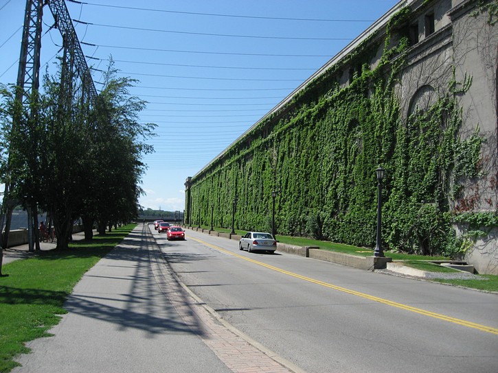
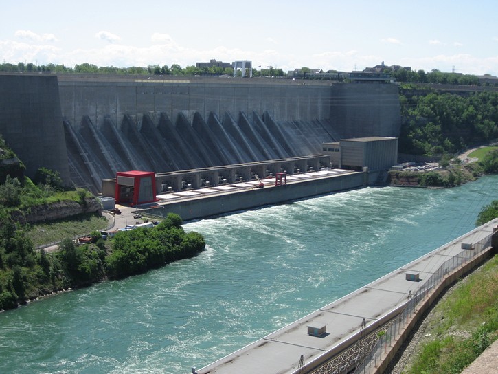
Shortly after passing the area with Brock’s Monument, the path takes an interesting route across the top of a dam and power generating station. A little later on, the path crosses the Parkway and cuts through the parking lot for the Niagara Parks Botanical Gardens. In fact, you will notice that the path on the first leg of the Niagara-Welland loop often crosses through parking lots of various tourist attractions. Sometimes it is not immediately obvious where the path resumes, but if you use your sense of direction, it shouldn’t be too hard to figuring things out.
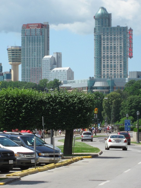
Tourist Central at Niagara Falls
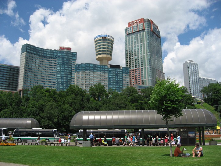
You will now be on the final stretch to Niagara Falls. It’s a little eerie to see how a nice relaxing route along the Niagara River transforms itself into a zone of tourist frenziness. The path will eventually dump you onto to the Parkway, where you cross the road to ride on the paved shoulder. However, this shoulder will soon disappear, either because the painted demarcation line has been worn away by traffic, or because it was never painted. When you get near the falls, you’ll be in thick of stop-and-go traffic as it intermixes with a large number of pedestrians who are crossing the parkway to get a better view of the falls. It all looks a bit chaotic , and you may wonder if this is any place for a bike. Fortunately, there is a logic to the flow of the slow moving traffic, and riding this area isn’t as scary as it first appears.

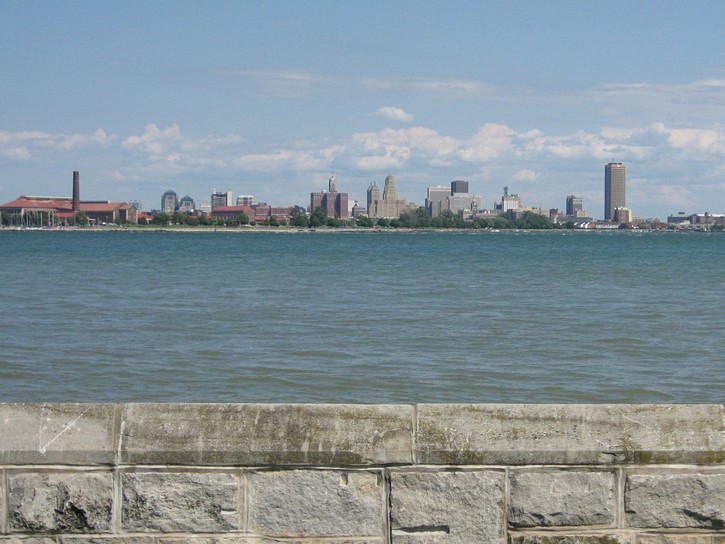
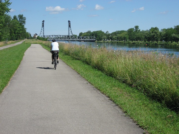
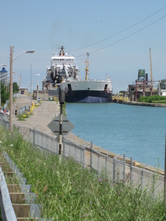
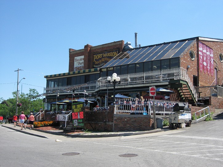
The area immediately opposite the Niagara Falls – the centre of all touristic in the region. (scroll to the bottom for more photos)
The carnival atmosphere tapers off quickly once you pass the Horseshoe Falls. At first you will be riding a short distance on the Parkway, then on a paved shoulder, and finally, on a separate bicycle path (located on the left side of the Parkway). You will soon find that the pathway brings you over a long narrow cement structure which crosses the mouth of the Welland River.
Once you have crossed over this structure, you will reach a point on the path where there are very few, if any, restaurants or places to get food or cold drinks for the next 28 kilometres. If it is around lunch time, and you are looking for something to eat, you may want to backtrack half a kilometre along the Parkway and Bridgewater Street (which runs next to the Welland River) to the town of Chippawa. You soon come to a main street which crosses the Welland River where you’ll find some fast food restaurants, convenience stores, pubs, and even a few motels (on both sides of the river). Compared to Niagara Falls, Chippawa is a much less hectic.
Given that Chippawa is located only a couple of kilometres south of the falls, this community may also be an option for people who are looking for a reasonably quiet place to stay overnight. The only other option would be to stay at one the multi-story hotels in the middle of the Niagara Falls tourist zone. However, these tend to cater to tourists who arrive by car or large tour bus, and they may not be very bicycle friendly.
Niagara Falls to Fort Erie
The ride between Chippawa and Fort Erie is pleasant enough, but not nearly as interesting as the first leg of the journey. Gone are the vineyards and the frequency at which you will come across historical sites and plaques. While the Niagara River will be in full view, it will no longer flow in a deep ravine and will now look relatively tame.
After a while you’ll notice that the path is laid out in a manner so that it incorporates a series of service roads which run parallel to the Parkway. These service roads are not very long, and exist to allow homes to be built in the area without being directly on the Parkway. By their very nature, they have almost no traffic. Nevertheless, riding a route which alternates between service roads and bicycle paths can become a little monotonous after a while. As a result, some people simply opt to cycle on the Parkway itself. Although it has no paved shoulder, there is not that much traffic on this part of the Parkway on weekday afternoons.
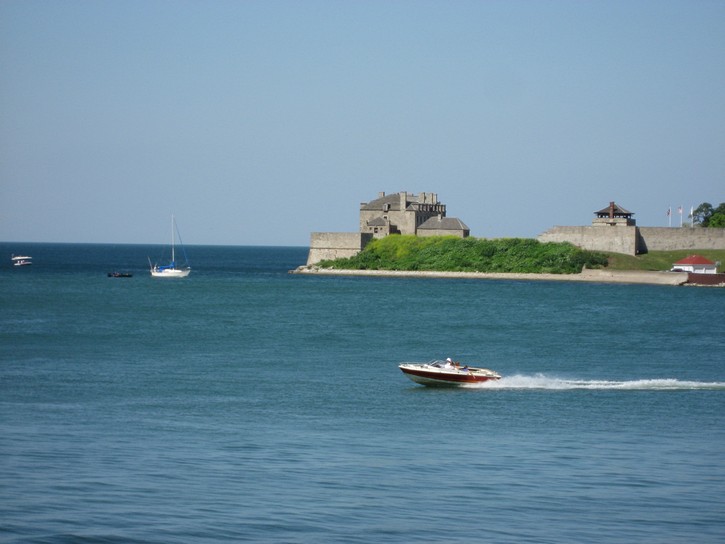
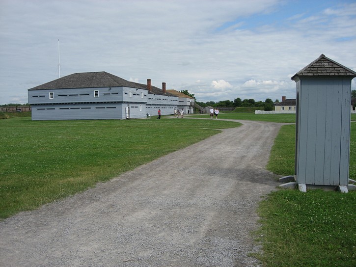
The path comes to an end as you approach Fort Erie. Here you will be able to cycle on a paved shoulder of the Parkway, which soon becomes Lakeshore Road. Because of its location toward the souther end of the Niagara-Welland loop, Fort Erie may seem like a logical place to look for accommodations to spend the night. While this town does have a large horse race track, nice subdivisions, and friendly people, it is totally devoid of an interesting downtown core. With the exception of the Old Fort Erie Historic site, there is very little to see or do here. Garrsin Road is the closest Fort Erie comes to having a downtown area, and it tends to resemble a big-box store strip. Here you find two well known motor inns and restaurants of a similar nature. You may want to consider this area if it is late in the day and all you are looking for is a comfortable place to stay.
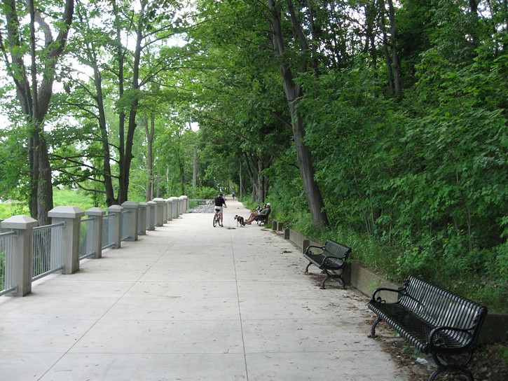
The pathway resumes just before the Peace Bridge, which spans the mouth of the Niagara River between Fort Erie and Buffalo, NY. The next 4 or 5 kilometres of the pathway is quite nice as it runs along the Lake Erie waterfront. It eventually passes by the Old Fort Erie historic site, which includes Canada’s bloodiest battlefield. The path then turns inland, runs along a couple of residential streets, and becomes the Friendship Trail. This trail was built on an abandoned railroad, and is essentially a straight line which runs all the way to Port Colborne. The Friendship Trail is paved, well signed, in good condition, and almost 25 kilometres long. It passes through both forested and open areas, but it runs a little ways inland and is not in visual distance of Lake Erie.
The Friendship Trail to Port Colborne
Before you start off on the Friendship Trail, you should be aware that there is very little in the way of facilities for overnight accommodations between Fort Erie and Port Colborne. If you are looking at a local map of the area, you may be tempted to check out the Crystal Beach area on the shores of Lake Erie. However, this waterfront district seems to have fallen on hard times, and there isn’t much there. Several of the beachfront motels have either closed or been converted into apartments, and the area’s selection of restaurants and stores is not overwhelming.
It appears that the only facility worth considering in this area is the Crystal Beach Motel on Ridgeway Road, about one kilometre south of the trail ( turn left onto Gorham Road which becomes Ridgeway Road). This motel is not on the waterfront, but does have a pool and there are a couple of restaurants in walking/cycling distance. There is also a beach and public park where Ridgeway Road ends at Lake Erie. While this motel is nothing very special, it is popular with some cyclists because it is located roughly at the mid point of the southern end of the Niagara-Welland loop.
From Crystal Beach it is approximately 15 kilometres to Port Colborne, where you find a reasonably good assortment of restaurants, bed and breakfasts, and motels. The only problem with using Port Colborne as an overnight destination when cycling from Niagara-on-the-Lake is that you will have covered over 80 kilometres in one day. This may start to become a long ride for some people.
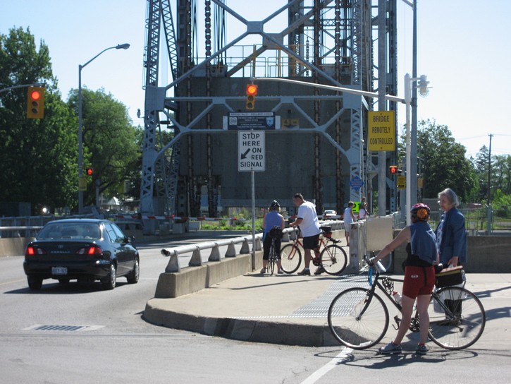
As you approach Port Colborne, the Friendship Trail automatically brings you to Durham Street which leads to a lift bridge that crosses the Welland Canal. You will want to cross because most of the town’s services and facilities are located on the west side of the canal. Note that if you arrive when the lift bridge is up to allow a slow moving ship to pass through the canal, you may be forced to take a 15 to 20 minute rest stop.
Port Colborne has more to offer than Fort Erie, but it is nowhere near as touristy as Niagara-on-the-Lake. While Port Colborne doesn’t try to hide its origins as a working class town, it is making slow but steady progress at reinventing itself as a tourist destination. There are a couple of interesting restaurants, bars, and speciality shops on West Street (right next to the canal), including an ice cream bar that stays open late on weekday evenings. In addition to several bed & breakfasts, you will find some motels along Highway 5 (Main Street) towards the north side of town.
If you are looking for a nice place to stay, you may want to consider the King George Inn at the corner of King and Clarence Street (one block west of the canal). Downstairs there is a large attractive pub, complete with an outdoor terrace. Upstairs there are a dozen well appointed rooms which are available at reasonable rates. When checking in here, you will be invite you to bring your bike indoors for safe keeping.
Port Colborne to St. Catharines
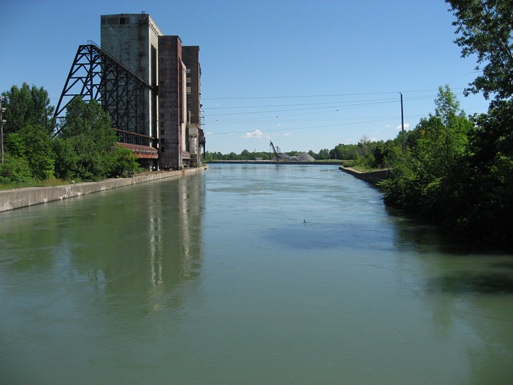
The bicycle path between Port Colborne and St. Catharines runs north along the Welland Canal, and it is a little over 40 kilometres long. While this route isn’t super spectacular in terms of scenery, it is still quite interesting. In a number of places the path jumps back and forth between the older versions of the canal which are no longer in service, and the present day canal. You will often be riding right next to the water, and in some areas the path actually runs between the canal and the bollards (the large yellow posts which ship use to tie up to shore).
It is worth noting that the present canal first opened in 1932 and provided the impetus for a lot of Canada’s economic growth during the last century. Earlier versions of the canal were competed in 1829, 1854, and 1887, but these could not accommodate very large boats. The current canal can handle ships up to 740 feet in length, and it usually takes 9 to 12 hours for a vessel to go through the canal’s eight locks and transit the entire system. (The author of this site once helped lock a 35 foot sailboat through the canal, and it was a long hard day.)
When heading north from Port Colborne, the pathway starts off on the east side of the Welland Canal but quickly crosses over to the west side. You’ll have to make an effort to keep track of the path as it crosses some of the streets in town. Once you get a little ways out of Port Colborne, you might get the impression that the path is going in the wrong direction. There’s no need to worry – the path takes a bit of a detour to get around a large Robin Hood Flour silo structure.
The City of Welland is the next major point of interest along the canal. It is one of the region’s larger urban centres with a population a little over 50,000. This city is not overly touristy, but has a good selection of services and accommodations. Here you will find several bed & breakfasts and a number of well know hotel chains, so this city could serve as a base when planning your ride around the Niagara-Welland loop.
In the City of Welland the pathway crosses over to the west side of the canal. To stay on the official path, you should turn left on Main Street and cross the bridge over the canal (there are signs indicating this). However, you also have the option of staying on the east side of the canal by continuing straight ahead. Here you will find a path with a paved surface that runs for another 4 to 5 kilometres through a nicely groomed city park. Unlike the path on the west side, it is well shaded by trees, which will make the ride all the more enjoyable on a hot sunny afternoon.
The only problem is that this route through the city park is a cul-de-sac. Once you get to the end, it comes to a complete stop, and there is no official way for bikes to get back to the main pathway on the west side of the canal. Unofficially, a lot of cyclists appear to make good use of a railway bridge which conveniently crosses the canal in this area. The bridge itself is about 70 feet long (20 metres), and the rail line doesn’t seem to get much use, so walking a bike across it seems to be a fairly straight forward proposition. Nevertheless, this is a bridge for trains, not bikes, so any decision to use it is entirely yours. (In other words, use it at your own risk.)
Locking through the Welland Canal
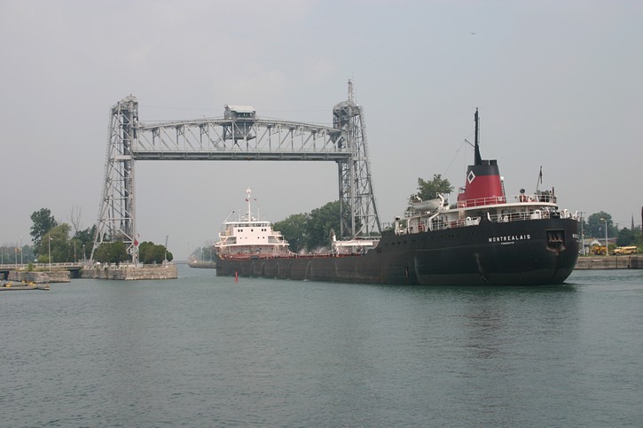
In another 5 or 6 kilometres, you will find yourself riding along that part of the canal that is currently used for commercial shipping traffic. This means you will probably see large ships, and sometimes small flotilla of pleasure boats, as they work their way through the system. You can get a closer look at the workings of the canal as you approach Lock 7, which is part of a series of locks which raise or lowers ships up or down the Niagara Escarpment. For people who want to take time to see what is happening, there is an outdoor seating stand right next to Lock 7, as well as an information centre across the road. However, anyone stopping to check out the action will soon discover that everything seems to move in slow motion when large ships manoeuver in and out of the locks.
Lock 7 is located in the town of Thorold, which for all practical purposes has to be considered a suburb of St. Catharines, the largest urban area in Niagara Peninsula. Whatever the case, you may want to take a quick detour into Thorold for a bite to eat or to buy cold drinks.
When you arrive at Lock 7 from the south, you will see a sign which seems to direct cyclists onto a road which leads to Thorold. In reality, the path resumes a hundred feet (30 metres) to your left on the other side of the road. You can pick up the path right next to the parking lot for the Information Centre at Lock 7. It’s easy to figure out when you know what you’re looking for, otherwise you may spend a little trying to find the resumption of the path.
After Lock 7 you will descend a couple of long hills. Needless to say, these have to be climbed if you are doing the Niagara-Welland loop in a counter-clockwise direction. For some reason, these hills seem bigger than the corresponding hills on the opposite side of the loop next to the Niagara River. From here on in, you will be riding through the outskirts of St. Catharines, a city with a population of over 100,000. The part of the pathway which runs along the Welland Canal officially comes to an end where it intersects Lakeshore Road (about one kilometre before Lake Ontario). In order to complete the Niagara-Welland loop, you can turn right onto Lakeshore Road and head east to Niagara-on-the-Lake, but more on this later.
To Port Dalhousie
Instead of going back to Niagara-on-the-Lake right away, you may want to check out Port Dalhousie by heading west for 5 or 6 kilometres. Port Dalhousie is now part of St. Catharines, but it was the community located at the entrance of the first Welland Canal built between 1824 and 1829. It is now a tourist centre similar to Niagara-on-the-Lake, only smaller, and maybe a little rowdier.
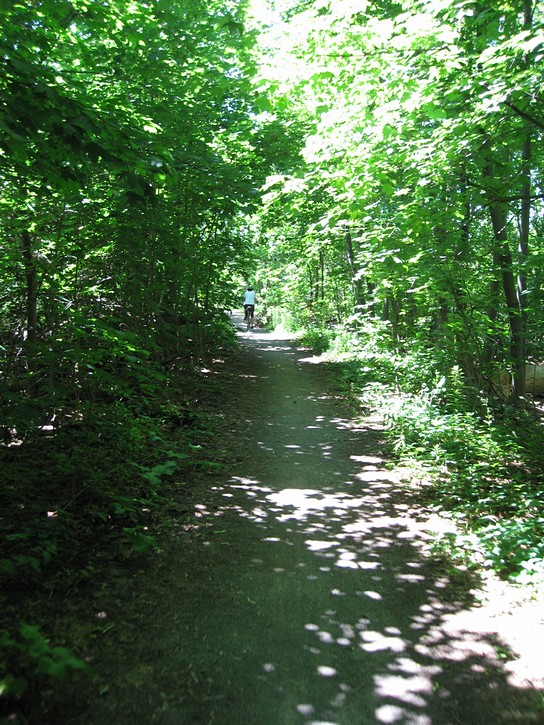
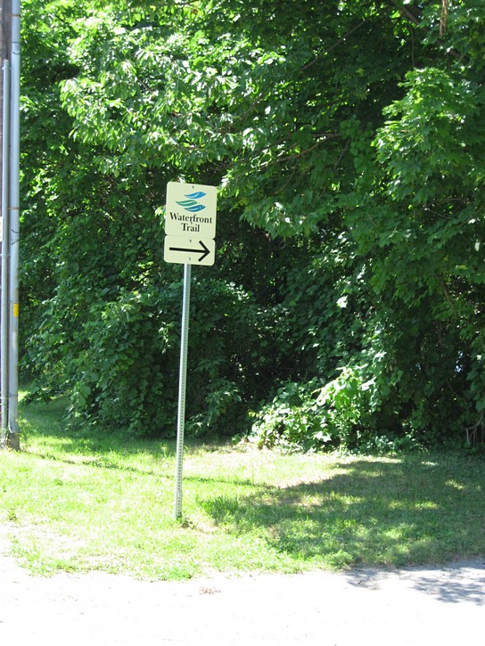
To get to Port Dalhousie, you can cross Lakeshore Road go straight for a few hundred feet until you see a sign for the Waterfront Trail, and tun left onto it. You quickly realize that this trail is quite different from the path which runs next to the Welland Canal. This part of the Waterfront Trail runs along various roads (indicated with signs) which link up a series of parks. At times, you find yourself riding through pure suburbia, or on narrow paths in forested parks. At one point, the trail run along a large sparely crowded beach, where, on a clear day, you will get a good view of Toronto across Lake Ontario.
This Waterfront Trail eventually brings you back to Lakeshore Road, on which you cycle west for a little over half a kilometre. Unfortunately, this segment of the Lakeshore Road can be fairly busy, and it has no paved shoulder. To get to Port Dalhousie, turn right when you get to Lakeport Road (which has a nice bicycle lane). If you are looking for overnight accommodations in this part of St. Catharines, there are a couple of well known motel/hotel chains just a little further west on Lakeshore Road (which becomes Ontario Road).
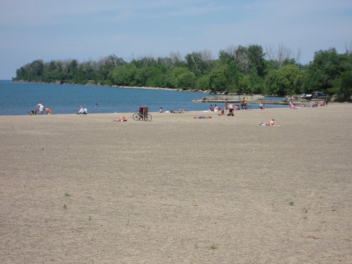
The tourist section of Port Dalhousie is nestled in between Martindale Pond and Lake Ontario, right next to a marina. The area is only a couple of blocks long, but it is packed with restaurants and bars, as well as some stores and boutiques. Many of the restaurants and bars have terraces in the back which open up on Hogan’s Alley. When this area gets crowed in the evenings, it can look like one giant outdoor patio. Adjoining this area is a waterfront park where you’ll find a public beach, change rooms, and piers which jet out into Lake Ontario for a considerable distance. This is also where the entrance to original Welland Canal was located. A good number of transient boaters make use of these old canal facilities to tie up for overnight stay when sailing around Lake Ontario.
When departing Port Dalhousie to get back to the Niagara-Welland loop, you can retrace your route along the Waterfront Trail. Another option is to stay on Lakeshore Road for the 4 or 5 kilometres. As mentioned earlier, this stretch of road can be busy, and the portion Lakeshore Road west of the Welland Canal has no paved shoulder. Fortunately, you’ll find a good paved shoulder along Lakeshore Road once you get on the east side of the Welland Canal. To complete the Niagara-Welland loop, you can stay on Lakeshore Road for another 12 kilometres until you arrive at Niagara-on-the-Lake.
There is one problem with this last part of the route. When you get closer to Niagara-on-the-Lake, there is a two to three kilometres section of Lakeshore Road that has no paved shoulder. Making matters worst, this segment of the road is busy with tourist traffic and it has a few twists and turns that can make it difficult for motorists to see cyclists. It is not ideal for biking and is probably the most serious flaw in the entire Welland-Niagara loop (note that there are plans to correct this situation in a year or two).
If you want to avoid this troublesome gap, you can always turn left onto “East West Line Road”. It has a narrow paved shoulder and less traffic. Here you will be riding along backsides of the vineyards which many tourists never get to see. When you get to Niagara Stone Road, turn left to head into Niagara-on-the-Lake. You’ll quickly get a sense of how to follow this alternate route by taking a quick look at a map of the area. When you get into town, you have officially completed the Niagara-Welland loop.
Planning your ride
As mentioned earlier, this article assumes that you will be riding the Niagara-Welland loop in a clockwise direction, stating at Niagara-on-the-Lake, and that you will complete it with one overnight stopover. Needless to say, there are many other ways of planning your ride around the loop.
Your choice of a starting point will probably be influenced by how you arrive in the region, If you come by car, you could start in any number of places, including St. Catharines, Niagara Falls (or Chippawa), Port Colborne, Welland, and so on. If you arrive on Via Rail’s “Bike Train”, you would have the option of starting your ride from either the St. Catharines station, located approximately 5 kilometres west of the Welland Canal, or the Niagara Falls station, located almost next the Niagara River, and about 3 km north of the actual falls.
It is fairly common for people to complete the 140 kilometre Niagara-Welland Loop over a two day period, but this means having to spend one day cycling a distance of 75 to 80 kilometres. If this is outside your comfort zone, you should come up with an itinerary that will allow you to cycle the loop in 3 or 4 days.
Regardless of how many days you will be cycling, you will want to plan your overnight stops at interesting places with things to see and do, and that offer a good selection of restaurants, motels, inns, or bed & breakfasts. This could be a challenge in the southeast corner of the loop. Although there are comfortable accommodations available at Fort Erie (and the lone motel at Crystal Beach), this part of the loop may have the least to offer in terms of interesting places for an overnight stay.
When planning a multi day ride in the area, remember that it is not necessary to have each leg of the trip divided up into equal segments. For example, the part between Niagara-on-the-Lake and Niagara Falls is a little under 25 kilometres long, and could easily be covered in an hour to an hour and a half by most cyclists. However, this segment of the loop is loaded with great vistas, historical sites, and attractions that are waiting to be visited. You could easily stretch this leg into a one day ride if your were, for example, to visit Fort George, take a tour of one of the wineries, check out the Printery & Newspaper Museum or the Niagara Parks Botanical Gardens, and spend a bit of time at Niagara Falls itself.
And finally, keep in mind that the cost of food and accommodation in the region can range from very expensive to quite reasonable. Prices will generally be lower in the less touristy centres such as Fort Erie and Port Colborne, and higher in places like Niagara-on-the-Lake and Niagara Falls. One of the best deals for inexpensive overnight accommodations in the Niagara Peninsula can be found at Brock University in St. Catharines. It make rooms available to cyclists during the summer for $57 (the price as of 2008), and this includes an “all-you-can-eat hot buffet breakfast”. The university is located about 4 kilometers west of Lock 7 on the Welland Canal.
Michael McGoldrick,
July, 2008
[feather_share]
(Click on the map for a larger version.)
(Click on the images for larger photos)