Cycling around Thunder Bay
Cycling in and around
Thunder Bay on Lake Superior
(Scroll down to the bottom the this page for map and photos.)
Thunder Bay may be off the beaten track for many people, but it occupies a unique place in Ontario’s northwest corner, and it is Canada’s only real city on Lake Superior. It also has a few surprises in store for anyone who wants to get to know the place. For example, Ontario’s highest cliffs are found nearby in the Sleeping Giant Provincial Park, and culturally, Thunder Bay is home to the largest Finnish community in the world outside of Finland (complete with a weekly Finnish newspaper).
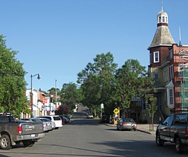
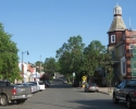
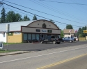
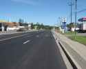
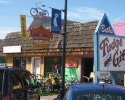
Bay Street in Thunder Bay
(scroll to the end for more photos)
Although it is easy to assume that Thunder Bay is mainly about mountain biking and trail riding, the area has plenty to offer road cyclists. A little research will also reveal that the city is home to the Thunder Bay Cycling Club, which has a long track record of promoting and facilitating road cycling. (Members of this club also tend to get around – you can find them sporting their clubs’ jerseys in many of the popular cycling spots in Ontario.)
The main draw back with Thunder Bay is that it seems to be far from everything. It’s a long two-day drive from cities like Ottawa or Toronto, and from the west, it’s an eight hour drive from Winnipeg. The closest city is Duluth in northern Minnesota. This means getting there becomes an issue for anyone who would like to visit Thunder Bay.
Getting to Thunder Bay
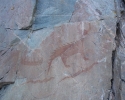
Driving there with your bike in the car is obviously one possibility. Although long, the drive is worth it if only for the spectacular scenery you’ll encounter along Highway 17 where it hugs the shoreline of Lake Superior. Some of this scenery was the inspiration for paintings by the Group of Seven. There are also a number of things to stop and see along this stretch of highway, including the Agawa Rock Pictographs, one of the most visited aboriginal archaeological sites in the country (in the Lake Superior Provincial Park about 150 km north of Sault Ste. Marie).
One of the things you are likely to notice along this part of Highway 17 is a surprising number of cyclists, anywhere from 10 to 20 on any given day. Most of them are cycling across Canada. Because Thunder Bay is one of the bottle necks for anyone planning a ride from coast to coast, many cyclists find themselves on Highway 17. Although some are cycling in small groups, many are riding solo. Almost all of them seem to be riding with bikes that are heavily loaded with everything needed for self-sufficient touring.
If this gives you the idea of travelling to Thunder Bay on your bike, consider the following: Highway 17 is a two lane highway (albeit with passing lanes at regular intervals), and it has a fair amount of truck traffic. Moreover, it only has a very narrow paved shoulders that are no more than a foot wide (30 cm) in many places. On top of all of this, you’ll have to be prepared to deal with a good number of challenging hills. And finally, when cycling from the east, you’ll be riding against the prevailing winds. Remember that most people who cycle across Canada do so in a west-to-east direction.
Flying has to be the easiest way of getting to Thunder Bay. Although it can be expensive, there’s enough competition on the routes that there are often seat sales with the airlines serving the city. If you do fly, you’ll probably want to rent a bicycle when you get there. Fortunately, there are a couple of places in Thunder Bay where it is possible to rent quality road bikes for a few days at a time at decent rates.
Thunder Bay – the amalgamation of two cities
Once you do get to Thunder Bay, you’ll find a city of a little over 100,000 people. You should be aware that Thunder Bay is the result of the amalgamation of Port Arthur and Fort William, two cities that were only a few kilometres apart from each other. Although they were amalgamated over 40 years ago, the residents of Thunder Bay still retain strong identities with their former cities. Local authorities have tried to foster a greater sense of unity by encouraging development in the land that used to separate Port Arthur and Fort William, but have only succeeded in creating a big-box retail strip.
It should also be noted that Thunder Bay’s urban areas are not overly touristy. The old downtown districts of what used to be Port Arthur and Fort William have been left to languish, and are not as vibrant as they could be. It’s not that Thunder Bay doesn’t have its share of interesting, good, and well patronized restaurants, pubs, coffee shops, bars, and speciality stores. It’s just that they tend to be spread out rather than being clustered together in a trendy downtown area.
The three bike shops which cater to road cycling are all located in what used to be Fort William (in the southern half of Thunder Bay). They are Fresh Air Experience, Petrie’s Cycle & Sports, and Cyclepath. At least two of these stores have had a few road bikes that they rent out (including models with drop bars), although this may vary from year to year. If you plan to rent a road bike in Thunder Bay, it would be best to contact the stores in advance to see what’s available. (I was very satisfied with the service and quality of the bike I rented at Petrie’s Cycle & Sports – but others may be just as good.)
To get you started, the following is an overview of three rides in the Thunder Bay region. They are not offered in any great detail, so you should probably get a map to figure out the specific routes, especially when leaving or returning into town. And finally, these rides start off from the perspective of someone departing from the northern half of Thunder Bay (what used to be Port Arthur), only because that is where I was staying when visiting my daughter.
Ride #1
Riding east along Lakeshore Drive
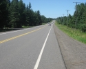
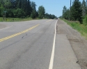
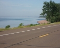
With this ride you’ll head east on Lakeshore Drive and back. The best thing about it is that Lakeshore Drive has a nice paved shoulder that is over a metre (3 to 4 ft) wide.
Depending on your departure point in Thunder Bay, the entire ride (there & back) will probably be about 45 to 55 kilometres long. This route parallels the shore of Lake Superior, but does not run right next to the waterfront. It is reasonably flat, although there are a few areas with long slopes (nothing too steep). If it’s a hot sunny day, this route will provide you with two opportunities to take a quick swim in Lake Superior.
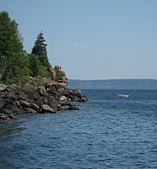
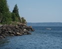
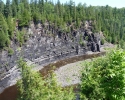
Small cliffs in the Silver Harbour Conservation Area.
An alternative route for crossing the north end of Thunder Bay is to ride along Court Street N, which is one block above Cumberland. It is worth mentioning because it’s one of the few streets in this part of Thunder Bay that has a designated bike lane. At the end of Court Street, there’s a city park with a multi-use bike path. Follow it and you’ll soon be riding next to Boulevard Lake and on the top of a small dam, which is kind of interesting. Once you get to the other side of the park, turn right towards Lake Superior to get to Cumberland Street. When riding in this area, resist the temptation to head south of Cumberland on a road that runs closer to the waterfront. It’s a dead end.
Regardless of the route you use, you’ll end up heading east on Strathcona Avenue. At one point Strathcona Avenue seems to come to an end at the intersection where it merges with Arundel Street. Keep right to stay on Strathcona Avenue. From here the routing is very simple. Just keep on riding. In a few kilometres Strathcona Avenue automatically becomes Lakeshore Drive, and continues for 18 kilometres until it comes to an end at Highway 11/17.
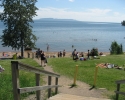
Except for those areas where you are able to get a good view of Lake Superior, the scenery along this road is not overly spectacular, but the ride is pleasant enough. Once you have been riding on Lakeshore Drive for 7 or 8 kilometres, keep an eye out for the Wild Goose Park on the right side of the road (it’s opposite the MacGregor Recreation Centre). Turn into the park and you’ll soon end up at a small public beach. While it seems to be very popular with the locals when it is hot out, there’s not much to the beach itself. Whatever the case, it does offer a chance to take a dip in the lake on a sweltering day. There are also public toilets nearby.
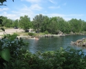
If swimming at this beach isn’t to your taste, push on for another 7 or 8 kilometres and you’ll come to the Silver Harbour Conservation Area. There are signs indicating the turn off for this area on Lakeshore Drive. From the turn off, it is necessary to pedal about a kilometre to reach Lake Superior (keep left at the fork in the small road). At the waterfront, you’ll find a small bay, few picnic tables, a boat ramp, and three public docks which are suitable for use as swimming platforms. Climbing up the rocks just to the east of the small bay will provide you with a nice view of the lake from the top of a small cliff (a little over 30 ft/10m high).
From the turn off to the Silver Harbour Conservation Area, it is another two kilometres to the turn around point at the end of Lakeshore Drive. It is possible to continue cycling further east, but this means having to ride along Highway 11/17, a busy two lane road that only has very narrow paved shoulders.
Ride #2
Kakabeka Falls and back
Heading out to the falls is a nice ride on the west side of Thunder Bay. It is an interesting destination because this waterfall is the largest one in the Lake Superior watershed.
Depending on your starting point in Thunder Bay, it’s about 30 kilometres to the Kakabeka Falls, which translate into 60 kilometre ride with the return portion of the trip. The route is quite flat with the exception of a hill or two as you get closer to the falls. The scenery in this area is mainly farmland. There isn’t much agricultural land in the area around the north shore of Lake Superior, and what little there is seems to be located just west of Thunder Bay.
To start the ride you have to get over to Oliver Road, which runs in the east-west direction one to two kilometres north of Highway 11/17. You can begin from the east section of John Street, which automatically becomes Oliver Road, or head north on Golf Links Road (which has a nice paved shoulder). There’s a Tim Horton’s and a Subway Restaurant at the intersection of Oliver and Golf Links Roads, which could come in handy if you want to grab an early morning coffee or a sandwich for later in the trip.
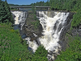
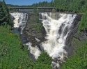
The Kakabeka Falls.
After cycling about two thirds (about 19 km) of Oliver Road, you come to the very small village of Murillo. There is a convenience store here where it is possible to buy cold drinks and something to snack on.
As you come towards the end of Oliver Road, it will turn to the left, decend a medium size hill, and bring you to Highway 11/17. You’ll turn right onto the highway and cycle for about a kilometre through the small town of Kakabeka Falls. The highway is extra wide where it passes through the town, so there should be plenty of room for cyclists and traffic. There is not much to this town of Kakabeka Falls – it seems to be collection of a couple of motels, a few restaurants, small stores, and gas stations that are sprawled out along the highway.
Once you have passed through the town, it will be possible to see the entrance to Kakabeka Falls Provincial Park on the left side of the highway. Don’t stop at the first parking lot after the entrance. Continue on the park road past the gatehouse and over the bridge that crosses the river a little above the falls. On your left keep an eye out for a park building which houses an interpretation center and ecological displays. In the vicinity of the building are some bicycle racks, picnic tables, public washrooms, a tap for drinking water, and vending machine with cold drinks (but there is no place to buy food in this area).
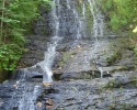
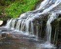
Opposite the park building is a boardwalk which provides an excellent view of the Kakabeka Falls. These falls are 131 feet (40 m) high, and are sometimes referred to as “Niagara of the North”. Old etchings suggests that the falls were larger than they are today (the water flow has probably been reduced by nearby hydro electric installations), and the first European explorers who passed through the area thought they compared favorably with the Niagara Falls.
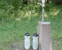
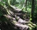
The tap (not a water fountain) for filling your water bottles is located on a small cement stand at the trail head of the “Mountain Portage Trail”, roughly between the washrooms and the interpretation centre. If you have the appropriate footwear, you may also want to consider walking this trail. The Mountain Portage Trail is a loop that is a little over a kilometre long, and provides good views of the water from the falls as it runs through a fairly deep gorge. This trail is quite tame and the walk will feel more like a stroll than a hike.
At the far end of this loop is the beginning of a real hiking trail. It is called the “Little Falls Trail” and it is a three kilometre loop through the forest that will probably take 1.5 hours to complete. Although it is a very nice, the difficulty level for this trail is rated as “moderate” or “strenuous”, so it may not be suitable for people who are not used to hiking. The trail leads to a 40 foot (12 m) waterfall that sprinkles down a rock facade that is tucked away in small enclave in the forest. A visit to the Little Falls is well worth the effort, especially if you enjoy hiking in the woods.
If you do hike any of these hikes, make sure you have enough time (and energy) to get back to the bike and pedal back to Thunder Bay.
Map for the ride to Kakabeka Falls (west of Thunder Bay).
Ride #3
Cycling to the US border
(and perhaps Grand Marais)
This ride will take you south of Thunder Bay to the Canada/US border. It’s fairly long ride. Depending on your starting point, it could be 62 kilometres one way, or 124 kilometres with the return trip, so you may not want to go all the way if you aren’t used to cycling such long distances.
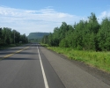
The routing for the ride is very simple. Just follow Highway 61 from Thunder Bay all the way to the border. You’ll be able to pick up Highway 61 right next to the Thunder Bay airport in what used to be Fort William (the southern half of the city). When heading out on Highway 61, be sure to bring everything you’ll need because as are no place directly on this road to stop to buy food or something to drink.
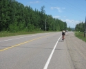
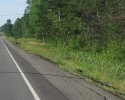
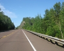
The good news is that Highway 61 has a paved shoulder that’s 3 to 4 feet (1 to 1.2 m) wide. The bad news is that when they last resurfaced Highway 61, they did not redo all of the paved shoulders. This means some sections of the shoulders are covered in old pavement, and they are starting to show it age in a few areas. Fortunately, there are long stretches where the older pavement is still in reasonably good shape. There are also places where new surfacing extends onto the shoulder, and this layer of new asphalt is slightly higher than the rest of the paved shoulder.
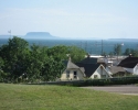
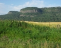
The terrain along the highway tends to be somewhat level insofar that there are no really sttep hills. However, there are a good number of sections where you’ll have to climb or decend long slopes. On the Canadian side of the border, Highway 61 runs inland so there is no view of Lake Superior. The scenery generally consists of forest, although the highway runs through farmland near Thunder Bay. However, this route does provide a good view of several mesas, or small table-top mountains. These elevated areas of land have a flat top with sides that are often steep cliffs, and they are more reminiscent of the landscape in Colorado than in northern Ontario.
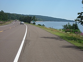
Highway 61 on the US side of the border.
If you do end up cycling all the way to the border, you may want to give some thought to crossing into the States and pushing on to the small town of Grand Marais. There are two reasons for doing so.
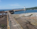
The first is Grand Marais itself. This town of 1500 on the shores of Lake Superior is a real tourist hotspot. It is sometimes described as everything that Thunder Bay isn’t. Grand Marais centre is packed with restaurants, boutiques, taverns, speciality stores, and the town is served by over a dozen motels, inns and bed and breakfasts. Its inner harbour is dotted with sailboats at anchor, and it is possible to take a relaxing walk on the breakwater that runs in front of Grand Marais. All in all, a nice place to take a break after a long ride.
The second reason for crossing the border is Highway 61. In the US much of this highway hugs the shoreline of Lake Superior, and in many places you’ll have an unobstructed view of the open water. The shoreline may not be as rugged as in Canada, but the view is spectacular nevertheless. Moreover, the American portion of Highway 61 has a paved shoulder that is in excellent condition, and it is 5 to 6 feet (1.5 to 1.8 m) wide in most areas. If only all the roads could have such nice paved shoulders.
The only problem is that Grand Marais is 65 kilometres from the border, or about 130 kilometres from Thunder Bay. Unless you are some sort of super endurance cyclist, this is much too far a for a day ride from Thunder Bay and back. In other words, you’ll have to come up with a suitable strategy for cycling to Grand Marais.
One possibility is to make it a two day trip, with an overnight stay at one of Grand Marais’s many motels, inns, or bed & breakfasts. Another possibility is to drive part way. If you have access to a car, load up your bike, and drive across the border. There are a couple of places (lookout points on Lake Superior) where you can park your car along the American section of Highway 61. Get you bike out, cycle to Grand Marais for lunch, and head back to your car in the afternoon. It appears that mid-morning or mid-afternoon border crossings don’t take too long on weekdays.
If you do head off to the US to do some cycling, remember that you should have the necessary health insurance and that you’ll need your passport or other acceptable ID to cross the border.
Other cycling routes
The rides described above are just a few examples to get you started. If you are looking for more rides in the region, the Thunder Bay Cycling Club (TBCC) generously makes maps of some of their rides available to the public on there website (click on the “RIDES” tab on their website’s navigation bar).
Michael McGoldrick,
July 2012.
[feather_share]

