Ottawa-Kingston via Perth & Westport
Biking from Ottawa to Kingston
via Perth & Westport
(Scroll down to the bottom the this page for map and photos.)
Kingston is an interesting destination that is probably just the right distance from Ottawa for people who would like to start doing some serious bicycle touring (sometimes referred to as cyclotouring). There are a number of options for cycling from Ottawa to Kingston, but the route that runs through Perth and Westport is one of the more popular rides.
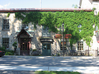
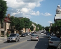
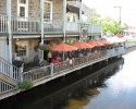
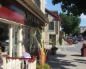
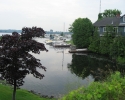
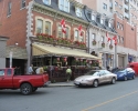
A scene in downtown Perth. (scroll to bottom for more photos)
Although it is well suited for cycling, this 180 kilometre route is not without its challenges. While large sections of this route takes place on flat terrain, you will encounter some sizable hills in several of areas. There are also long stretches of this route that make use of roads that have no paved shoulder and that can have a fair amount of traffic. However, it’s not all that bad. These roads are by no means the busiest in the area, and there aren’t that many trucks on them. Nevertheless, this route may not be ideal for people who are used to cycling on dedicated pathways or quiet country roads.
Even if you hate hills and dislike riding on relatively busy roads, there may still be something of interest for you here. The first part of this route between Ottawa and Perth is generally flat and generally make use of paths, trails, and country roads that are almost devoid of traffic. While this will not get you all the way to Kingston, Perth is a worthwhile destination by itself.
It should also be pointed out that the ride described below is similar to the “classic route” of the annual Rideau Lakes Tour that is organized by the Ottawa Bicycle Club. This is particularly true of the last part of the route from Westport to Kingston. For people unfamiliar with it, the Rideau Lakes Tour is one of the major cycling events in the National Capital Region, and takes place around mid-June every year. It features upwards of 1800 cyclists who ride to Kingston and back over a weekend.
Ottawa To Perth
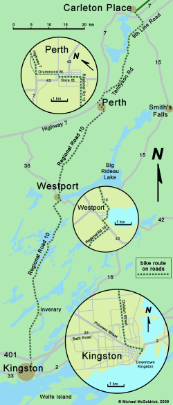
Depending on your departure point in Ottawa, it is approximately 75 to 80 kilometres to Perth. You will start off on the NCC path which leads to Britannia, follow the greenbelt trails through the west-end of town, and then take the Trailway to Stittsville and Carleton Place. For more details about this leg of the ride, see the articles on this web site about cycling to Stittsville and Carleton Place.
As you approach Carleton Place, the Trailway brings you onto Coleman Street. To get to downtown Carleton Place, you would continue on Coleman Street about a kilometre, and turn right onto Franktown Road at the traffic lights. However, to go to Perth, you will turn left to head south on Franktown Road. It’s also worth noting the Subway Restaurant on Coleman because this is one of the last convenient places to get something to eat before you get to Perth.
Franktown Road becomes regional Highway 15, and it is fairly busy. Although not very pleasant to ride on, you only have to stay on it only for about three kilometres. Highway 15’s redeeming feature is that it does have a narrow one foot paved shoulder. This, along with the fact that it is a relatively wide road, means that it is fairly easy for traffic to move towards the centerline and leave space for cyclists. Moreover, Highway 15 becomes noticeably quieter after it crosses Highway 7.
You will only be on Franktown Road (Highway 15) for less than a kilometre before arriving at the intersection for Highway 7. Here you see signs indicating that you continue straight to go to Smith Falls, or turn right onto Highway 7 to go to Perth. Do not turn onto Highway 7. It is part of the Trans Canada Highway, and is probably the busiest two lane road in eastern Ontario. Instead, you want to stay on Highway 15 (heading towards Smith Falls) for another two kilometres. You will then turn right on 9th Line Road (don’t turn on 10th Line, it’s dead end.) 9th Line Road road becomes Tennyson Road, and together they cover a distance of about 25 kilometres and will bring you almost all the way to Perth.
Although 9th Line and Tennyson Roads have no paved shoulder, they are nice quiet roads with very little traffic. There are a few mild hills in this area, but nothing to get excited about. Initially, 9th Line Road has a lot of middle class country homes, and later, it runs through a cottage area next to the Mississippi Lake. There is nothing wildly scenic about this route, but it is a little more interesting than the average county road. In 8 or 9 kilometres you have to get on Tennyson Road, but the transition from one road to other seems to happen automatically.
Tennyson Road ends at Highway 7 about three kilometres before Perth. Here you will turn left and ride along Highway 7 until you get to Drummond Street, where you’ll turn left to head into town. As mentioned earlier, Highway 7 is very busy and should be avoided whenever possible. Despite its deficiencies, Highway 7 is fairly wide and it does have a narrow one foot paved should, so riding on it for short distances is not intolerable. Moreover, you can further reduce the time spent on it by taking two shallow crescents (Wayside Drive & Dufferin Road) which roughly parallel Highway 7. These are located on the west side of Highway 7, and Wayside Drive is more or less the continuation of Tennyson Road.
Downtown Perth is located on Gore Street. To get to it, continue on Drummond Street for about ten blocks, or a little less than a kilometre, and then turn right on North Street, Foster Street, or any of the other roads in the vicinity.
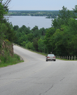
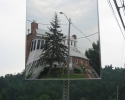
Part of the hill heading down into Westport
Perth is almost at the mid point when riding from Ottawa to Kingston, so it’s a good place to plan a stopover, either for a rest or to spend the night. Since Perth is about 80 kilometres from Ottawa, it would also be a good destination for someone who wants to ride a “century” with a round trip from the city. (A “century” is one of those cycling challenges which involves cycling 100 miles, or 161 kilometres, in a single ride.)
Perth to Westport
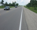
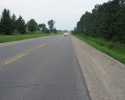
When leaving Perth to go to Westport, head east on Gore Street until you get to Regional Road 10 (on the opposite side of town from Highway 7). From here you essentially head south on Regional Road 10 all the way to Westport. Initially, Regional Road 10 is known as Scotch Line Road, and when you get closer to Westport, it’s called Perth Road. It has a good asphalt surface, but no paved shoulder. Unfortunately, Regional Road 10 can be a little busy. It will have noticeably more traffic that 9th Line or Tennyson road, but no where near as much as Highway 7.
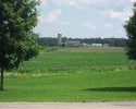
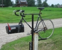
The first part of Regional Road 10 runs through farmland and is fairly flat, although it does have a few long slopes. Not long after leaving Perth you will pass by a residential mailbox on the side of the road that is supported by a stand made from an old 10 speed bike (the front forks hold the mail box, and it’s hard to miss when cycling along this road). As you get closer to Westport, your will be riding through a more forested area and you will eventually encounter a series of fairly significant hills. This is not the place for people who really hate climbing hills. They are not too long, so walking your bike up these hills is always an option.
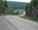
Just before you get to Westport, you have to go down a long steep hill. It has several curves, and you’ll get a great view of Westport and Upper Rideau Lake half way down your descent. If are you riding a heavily loaded touring bike, you’ll want to make sure your brakes are working well when heading down this hill. Needless to say this would be one of the tougher hills that would have to be climbed by anyone travelling in the opposite direction.
Westport is quite a bit smaller than Perth, but it is still one of the tourist centers in the region. It is popular with both land-based visitors and boaters cruising the Rideau Canal system, and is definitely worth a look around. It has a good size grocery store, a pub, a few restaurants, an inn, a couple of bed & breakfasts, as well some speciality stores. Since Westport is only 30 kilometres past Perth, it could serve as an alternate destination for an overnight stay, or a shorter stopover for a rest and a meal. If you plan to stay in Westport, it’s best to book your accommodations in advance because the place can fill up quickly during the peak tourist season.
Westport to Kingston
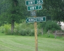
When leaving Westport to go to Kingston, stay on Regional Road 10 as it passes through town (where is it’s called Main Street). You soon come to a “T” intersection where you will have to turn left and cycle on Regional Road 42 for only a few hundred metres. You then turn right for the continuation of the Regional Road 10, which is also known as Perth Road (there are signs indicating all of this). From here, your routing is very simple – head south on Regional Road 10 for fifty-five kilometres until you get to Kingston.
As was the case with the earlier stretch of the Regional Road 10, this section has a good asphalt surface, but for the most part, no paved shoulder. Moreover, it is fairly busy, and it can have some truck traffic. It’s nothing overwhelming, but would not be suitable for people who do not like riding on roads where they must contend with passing cars and the occasional truck.
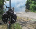
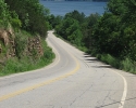
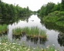
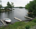
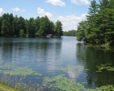
The good news is that for the next 25 kilometres, the road winds its way past several lakes, and you’ll be riding through one of the more scenic regions in eastern Ontario. (Have your camera ready.) This area is forested and has a mix of cottages and country homes. Although it is very picturesque, the area does have one shortcoming: there are really no places to stop. There are no stores, restaurants, snack bars, picnic areas, shelters, or rest areas on the portion of Regional Road 10 that runs through the Rideau Lakes district. When you do stop to enjoy the landscape, you’ll be standing on a gravel shoulder next to the road.
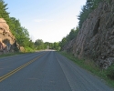
In addition to lots of twists and turns, you will encounter three or four fairly substantial hills when riding through the Rideau Lakes District. Many are located where there are small valleys, so you’ll have the fun of coasting down a rather steep incline before having to climb a corresponding hill a few minutes later. Once passed the Rideau Lakes District the terrain flattens out for 15 or so kilometres, but you will have to climb a few more hills as you approach Kingston.
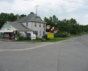
You will be coming to the end of the Rideau Lakes District when you get to the very small community of “Perth Road”. Here you come across a tiny convenience store, and there is another place to buy a snack or cold drinks when you reach the village of Inverary about 8 or 9 kilometres further down the road. In this area the scenery will generally consist of farm fields, and you may also notice that traffic starts to become a little heavier on Regional Road 10. Fortunately, the last part of the Regional Road 10 between Inverary and Kingston is reasonably wide and has a narrow one foot paved shoulder. This makes it easier for cars and trucks to leave a little more space when passing bicycles, although it would be nice to have a broader paved shoulder.
You will know that you are getting close to Kingston when you spot the cell phone towers that service the 401. On the other side of the 401, Regional Road 10 becomes Division Street, which runs for another 4 kilometres and will take you into the heart of Kingston. When you get to Princess Street, turn left and the way to Kingston’s downtown waterfront area will soon become evident.
For people who are unfamiliar with it, Kingston is human-scale city with a population of about 150,000. It has lots of history and old architecture, and it was once the capital of Canada in pre-confederation days. Its downtown core is very lively and is usually bustling with land-based tourists as well as sailors and power boaters who are cruising Lake Ontario or heading to and from the Thousand Islands. Kingston has numerous museums and historical sites, including Old Fort Henry. It offers an excellent selection of hotels, inns, bed & breakfasts, restaurants, pubs, bars and outdoor patios. In a nutshell, there’s plenty to see and do in Kingston, and you may want to consider spending a day or two here just being a regular tourist. To find out more about what’s happing in Kingston, or where to say, check out the tourist office opposite City Hall in the downtown waterfront area.
Note that because Kingston is such a popular tourist spot, hotels and bed & breakfasts in downtown area can be somewhat expensive during the peak season. However, relatively inexpensive rooms are available to the public during the summer months at the student residences at Queen’s University and St. Lawrence College (see links below).
Despite its reputation as a major tourist center, Kingston doesn’t go out of its way to cater to cyclists, and there are not many outstanding bicycle paths or routes in the city itself. However, there are some great riding opportunities in the areas around Kingston. This includes touring Wolfe Island or cycling east to Gananogue and the Thousand Islands Parkway, or west towards Picton and Prince Edward County.
Michael McGoldrick,
July, 2008
[feather_share]
(Click on the map for a larger version.)
(Click on the images for larger photos)

