Bicycling in Québec City
Cycling in Quebec City
(Scroll down to the bottom the this page for map and photos.)
Quebec has done much to improve itself as a bicycle-friendly city during the past couple of decades, although it still has a ways to go before catching up to Montreal. Nevertheless, Quebec City has to rank as one of the very best urban areas for cycling routes that offer some truly specular scenery.
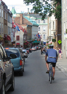
Cycling into Vieux-Québec.
(scroll to bottom for more photos)
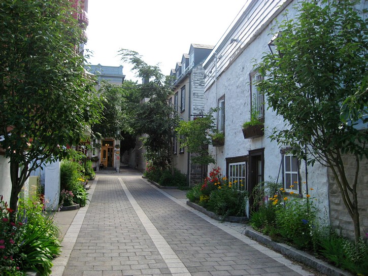
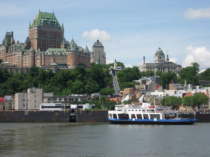
No description of Quebec would be complete without a mention of the old part of the city (Vieux-Québec). It is the only walled city in North America, and its narrow streets and architecture dating back to the1600s gives visitors the impression that they are in an old European town. Vieux-Québec is a surprisingly large area, and needless to say, it is a major tourist attraction that is packed with inns, hotels, cafes, restaurants, bars, boutiques, and shops. Because of its historical significance and its unique character, Vieux-Québec was recognized as a UNESCO World Heritage Site in the mid 1980s.
Ride #1
Cycling to the Promenade Samuel-De Champlain
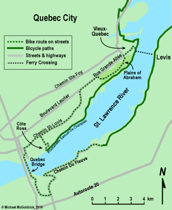
Cycling to “la Promenade Samuel-De Champlain” down along the St. Lawrence River waterfront is a nice ride for people who want to get to know what Quebec City has to offer. Depending on your starting point, and return route, this ride will probably be between 20 and 30 kilometres long. Most of the terrain will be fairly flat, with the obvious exception of the major hills to go down and up the escarpment (many recreational cyclists simply walk their bikes up the hill).
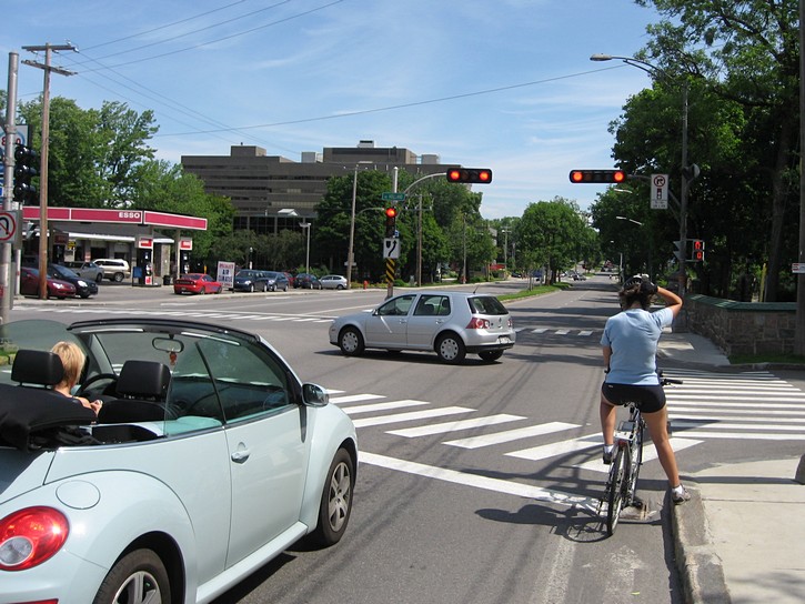
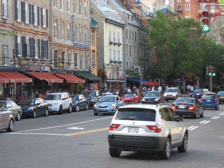
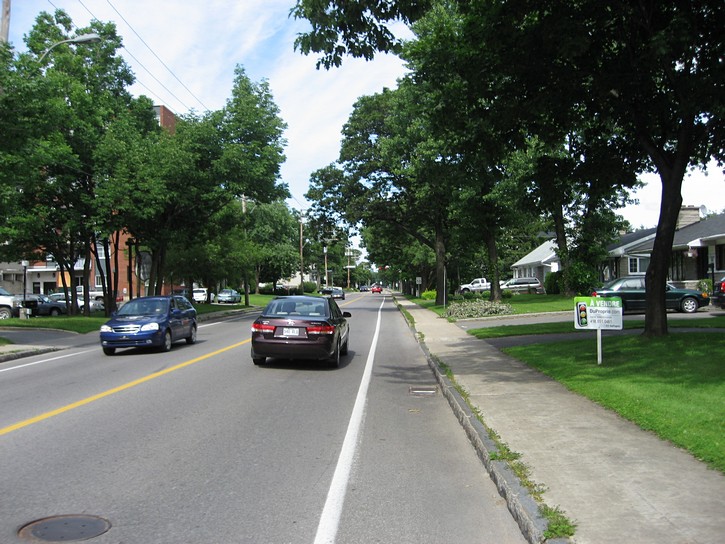
Since Quebec City’s centre is located on top of the escarpment, you would likely start somewhere there. This means you’ll want to head over to Rue Grande-Allée and cycle in an easterly direction (towards Vieux-Québec). Rue Grande-Allée is a main thoroughfare which runs parallel to the top of the cliffs. Although most of it doesn’t have a bicycle lane or paved shoulder, Grande-Allée is a wide boulevard-type of street that is fairly easy to cycle on outside of rush hour periods. The eastern end of Grande-Allée has a trendy tourist section where you pass by a good number of cafes, bars and restaurants.
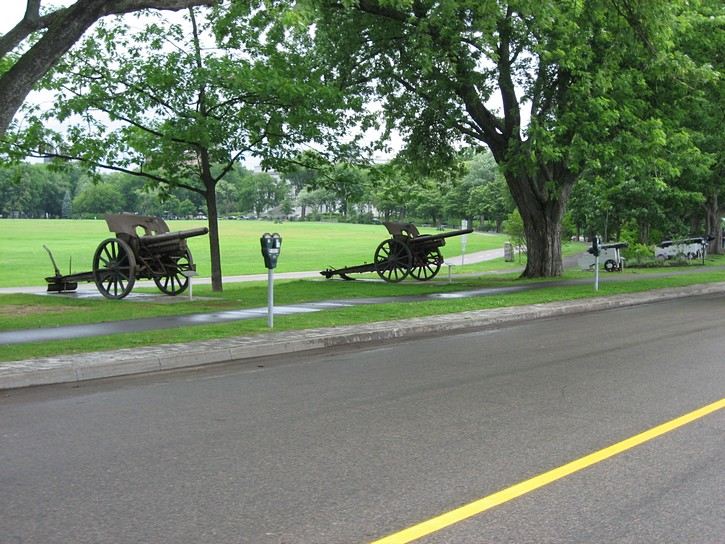
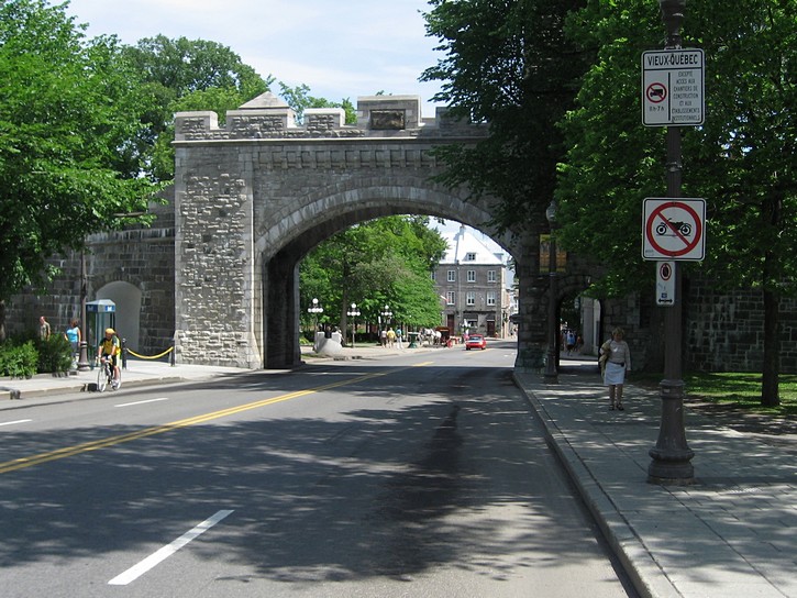
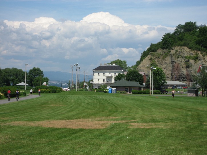
Instead of heading all the way to the end of Grande-Allée, keep an eye out on the right for the entrance to the Plains of Abraham (Battlefields Park). This park runs along the top of the cliffs, and it has several spots where you can get a breathtaking view of the St. Lawrence down below. There is also plenty of history here as this is where the famous battle took place between the French and English which affected so much of Quebec’s and Canada’s history. The park is also home to Quebec City’s Fine Arts Museum. Cycle to the eastern end of the park and you’ll exit onto the tail end of Grande-Allée. On your left will be the Assemblée Nationale (the provincial legislature) and on right will be one of the gates in the wall that surrounds the old city.
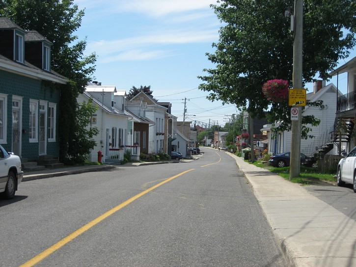
Riding through Old Québec
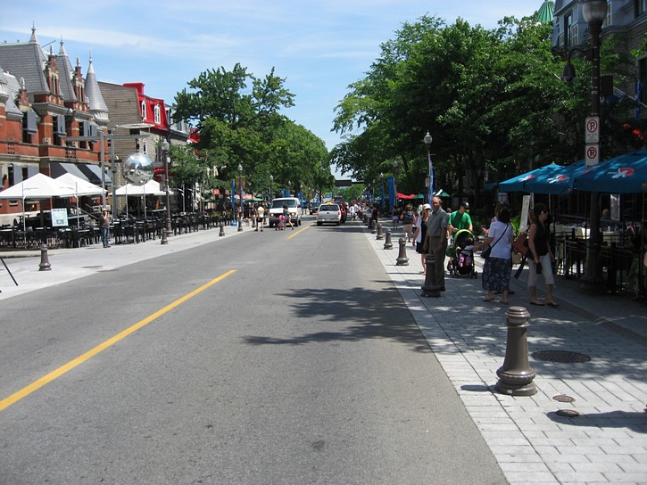
This particular gate is called “Porte St. Louis”, and you’ll want to go through it as part of your ride to the St. Lawrence waterfront. On the other side of the gate you will be on Rue St-Louis in Vieux-Québec. If it’s your first time here, you’ll quickly discover why this part of Quebec has an appearance and ambience that is very similar to the old quarter of a European city. There can be quite of bit traffic on it narrow streets, but it usually moves at bicycle speeds.
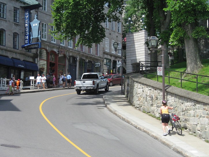
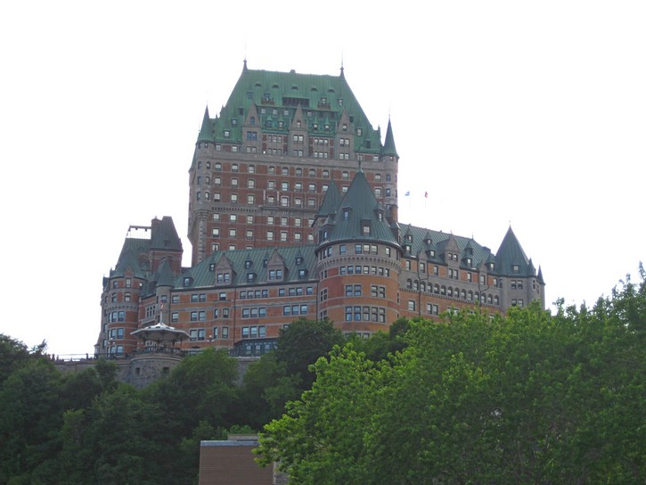
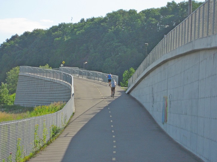
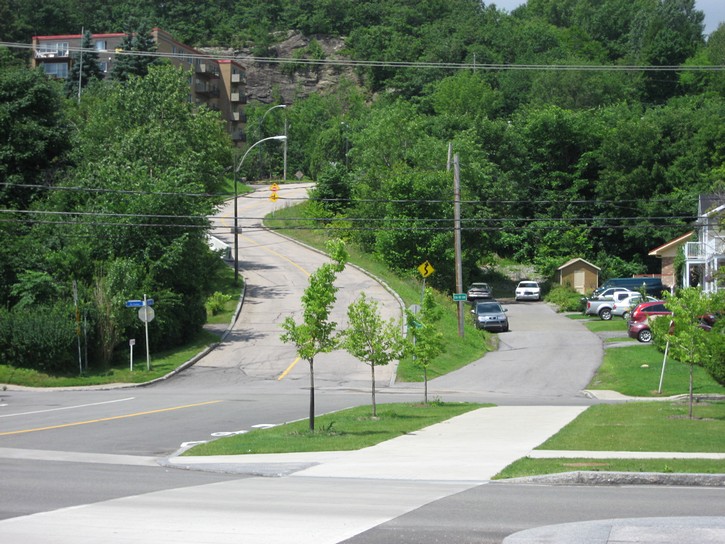
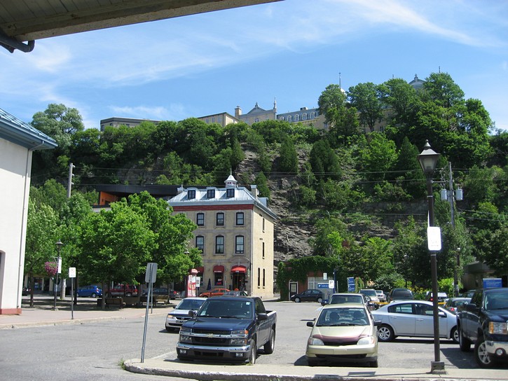
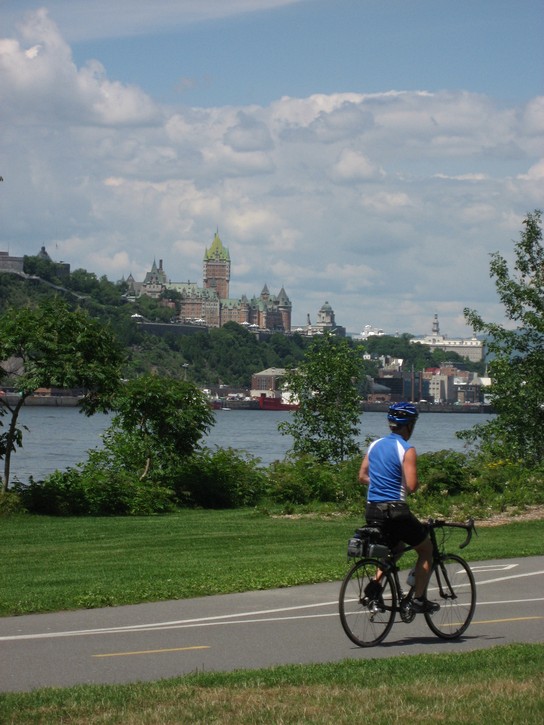
You continue on rue St-Louis for four or five blocks, at which point it turns to the left and becomes Rue du Fort. Here, on your right, you will be passing by le Château Frontenac, the large castle-like structure (a hotel) which dominates the Quebec skyline when viewed from the river. There is a downward slope on Rue du Fort, and you’ll stay on it until it veers to the right in about two short blocks. This is where you take a hard-right turn onto a street called “Côte de la Montagne” (which literally means “Hill of the Mountain”).
Yes, this is the beginning to the hill that brings you down to the level of the St. Lawrence River. It is quite steep and has several curves in it. At this point you may wonder how you will handle this hill on your return leg of the ride. The answer is very simple: walk your bike up the hill. If this sounds a bit disconcerting, spend a few minutes hanging out somewhere along this hill. It shouldn’t be long before you see a hardy cyclist huffing and puffing his or her way up the hill. However, for everyone of these determined individuals, you will see 4 or 5 cyclists who have sensibly decided to walk their bicycles up the hill.
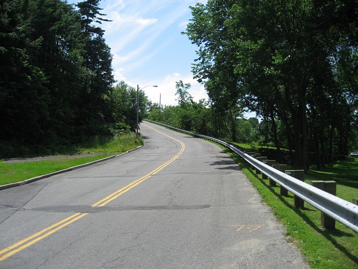
Good brakes for a steep hill
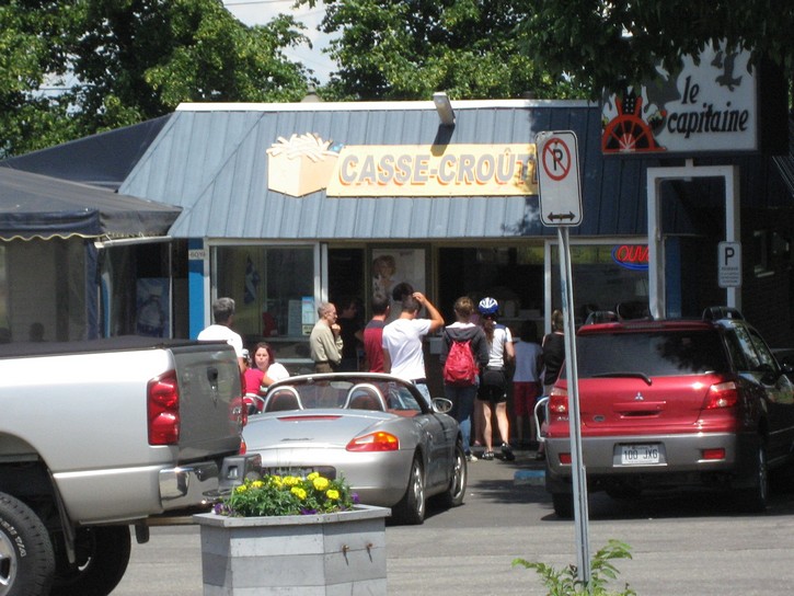
You want to make sure your brakes are in good working order when heading down Côte de la Montagne, especially if you are loaded for bicycle touring. It is also worth mentioning that as you take the first curve on this hill, you’ll pass by a staircase on the right which brings pedestrians down to a very picturesque part of the lower town. A photo of this scene is found in almost every tourist brochure for Quebec. The staircase is obviously not a route for cyclists, but this postcard setting is visible from the sidewalk next to the hill.
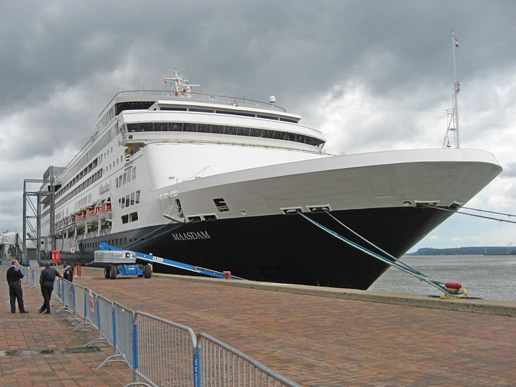
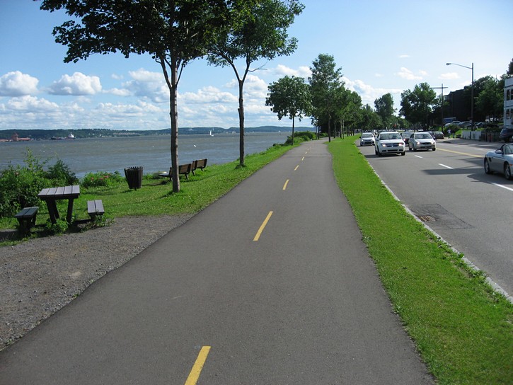
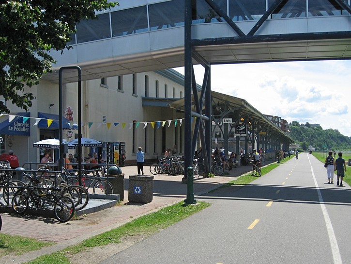
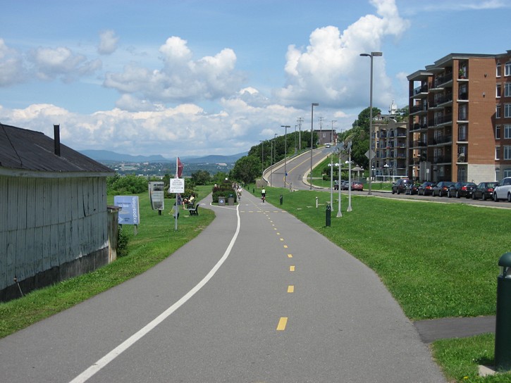
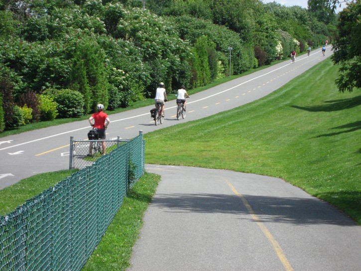
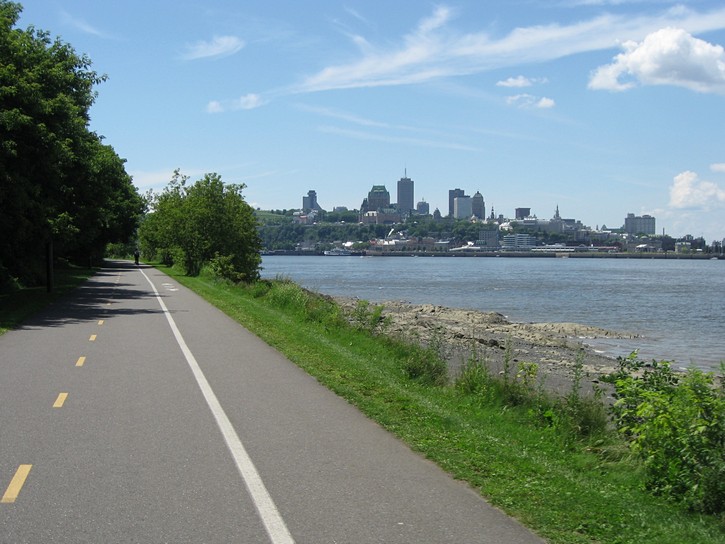
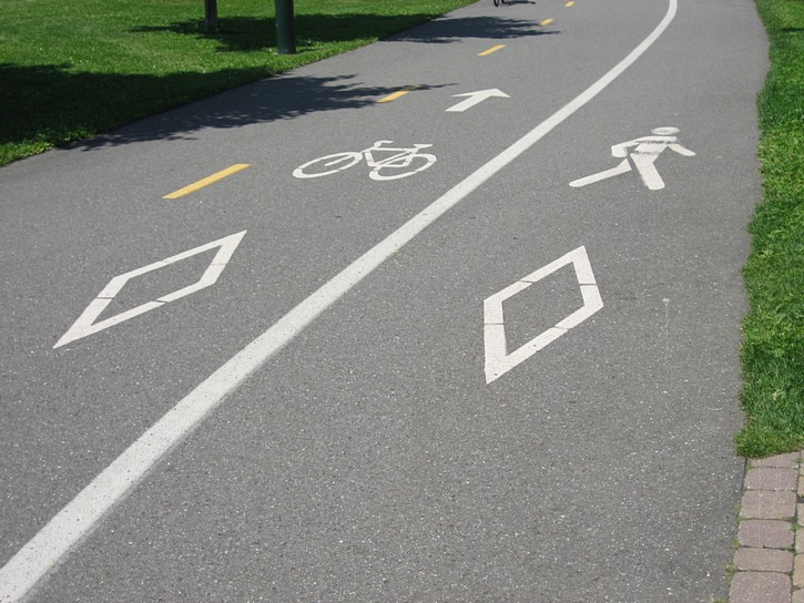
When you get to the bottom of the hill, continue straight ahead for a few short blocks until you reach the waterfront area. Here you’ll have to cross the parking lot to get to the bicycle path which runs along the river. This path is officially called “Corridor du Littoral”. It has an excellent paved surface and a number of areas with separate lanes for cyclists and pedestrians. You’ll also notice that the lower town can be quite busy. It’s another tourist hot spot, with all the usual cafes, restaurants, boutiques, and so on. Moreover, you could end up riding right next to large cruise ships that often tie up to the waterfront dock.
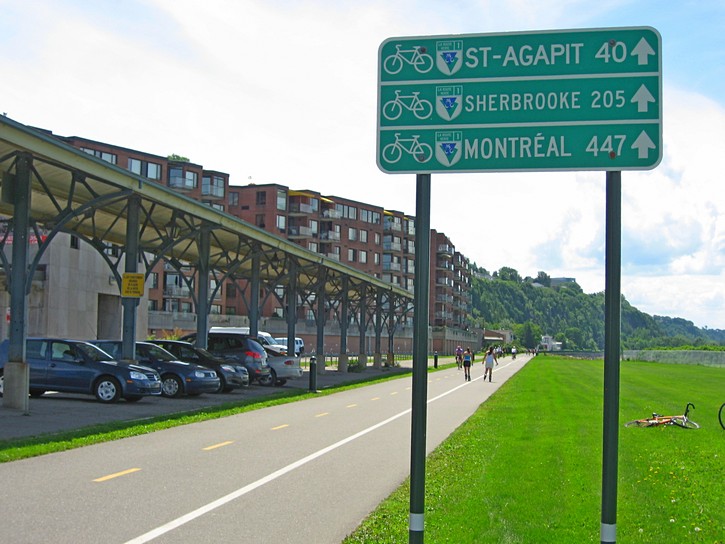
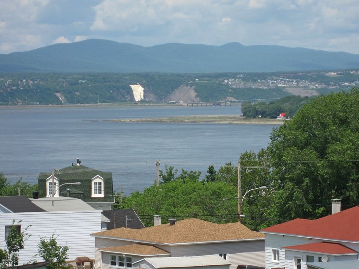
At this point you could turn left on the path and head east. In this direction the path runs for 13 kilometres, and it will lead you to the “Chute Montmorency”, the highest waterfalls in the Province of Quebec. These falls are 84 metres (275 ft.) high, and are a popular tourist attraction in their own right. Although the path to the Montmorency Falls follows the St. Lawrence River, a major 6 lane highway separates it from the shoreline.
Heading west along the St. Lawrence
While the Montmorecy Falls are an interesting side destination, for the purposes of this article, you turn right and head west for approximately 9 kilometres. In this direction the much of the path runs on a strip of land right next to the river, so intersections with roads are kept to a minimum. You will soon pass in front of the entrance for the ferry which provides regular service between Quebec and the small city of Levis on the opposite side of the St. Lawrence River. This area can get a little congested if you happen to be pedaling through just as a ferry arrives. Otherwise, you’ll probably see a line up of cyclists (and some cars) waiting to catch the next boat across the river.
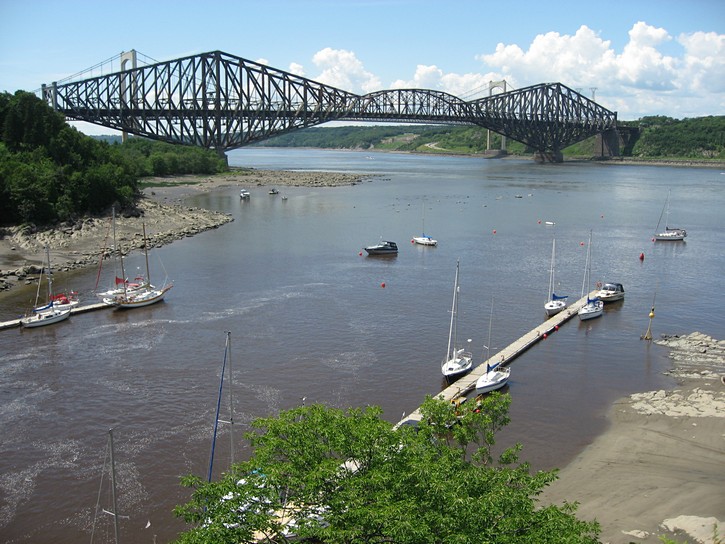
As you leave the lower town area you get an unfettered vista of cliffs and the St. Lawrence, and a little later on, the famous Quebec Bridge (with the longest cantilever span in the world) will come into view. Along the way you’ll pass by a fairly large yacht club, the vestiges of the industrial infrastructure that used to line this part of the river, and various residences that have popped up on the relatively narrow strip of land between the cliffs and the shoreline.
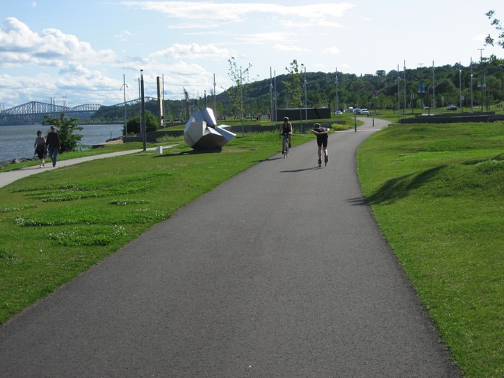
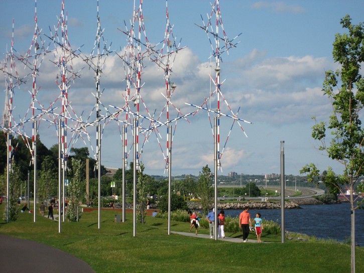
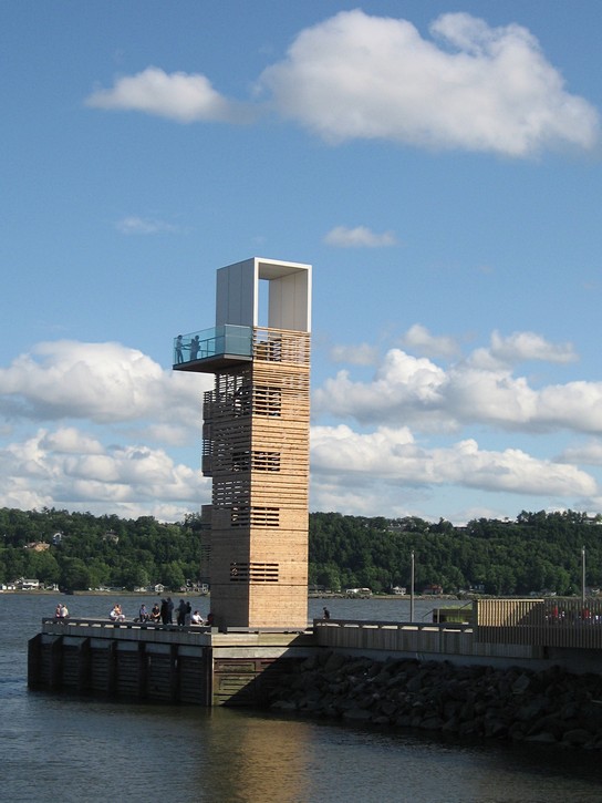
The last couple of kilometres of this path is called “la Promenade Samuel-De Champlain”. This area was only completed in 2006 for Quebec City’s 400th anniversary. It features a park-like setting, and has several large sculptures and other works of outdoor art. This part of your ride will have come to an end when you get to a quay (a wharf) that forms part of the park, and which has a tall wooden lookout structure, public washrooms, and a restaurant/snack bar facility. The official name of this place is the “Quai des Cageux”, and on nice weekends it is a popular congregation area with many Quebec City cyclists.
Once you have reached this quay, it will be time to make a decision on your return route. You could simply backtrack the way you came. Another option would be to climb the escarpment behind the quay and complete a loop to get back to your starting point on Rue Grande-Allée. Before opting for this, it should be noted that as of 2009, Quebec City lacks a good continuous bicycle path or lane that would allow cyclists to cross the upper town in an east-west direction. Apparently, the city is looking at ways to correct this, but it could take a while. In the meantime, the situation isn’t hopeless, and it’s possible to piece together routes that are reasonably comfortable to ride.
Return via Ross Hill
If you do decide to complete the loop, you’ll have to take Chemin Du Foulon which is located immediately behind the quay. In a few hundred metres, it will bring you to the bottom of Côte Ross (Ross Hill). Although this is a significant hill, it is easier to climb than “Côte de la Montagne”. If you are used to doing some hill climbing on a bike, you should make it to the top without killing yourself. If not, give it a go, see how far you can make it, and walk your bike the rest of the way.
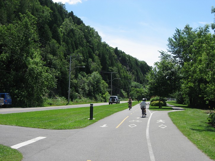
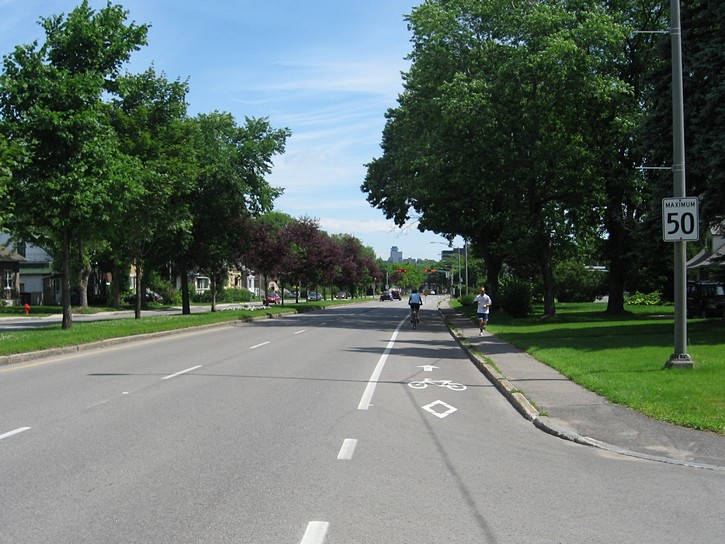
There is a residential area at the top of the hill. You’ll continue riding north on the street called Côte Ross for about 7 or 8 shorts blocks, and then you will turn right onto Chemin St-Louis. Initially, Chemin St-Louis has fairly a good bicycle lane which is about one metre wide. However, the width of the bicycle lane varies considerably, and there are sections where it is little more than a foot wide. It’s funny to see that in some areas the bicycle symbols that are painted on the pavement are wider than the space allocated for the lane. The bicycle lane will disappear completely as you cycle further east along Chemin St-Louis (but the road remains reasonably wide).
After three or four kilometres, the Chemin St-Louis veers to the north and comes to an end at Boulevard Laurier. Turn right onto Boulevard Laurier. In a very short distance it becomes Rue Grande-Allée, and you will soon pass the entrance for the Plains of Abraham and the area where you started the ride.
Ride #2
Crossing the St. Lawrence to Levis
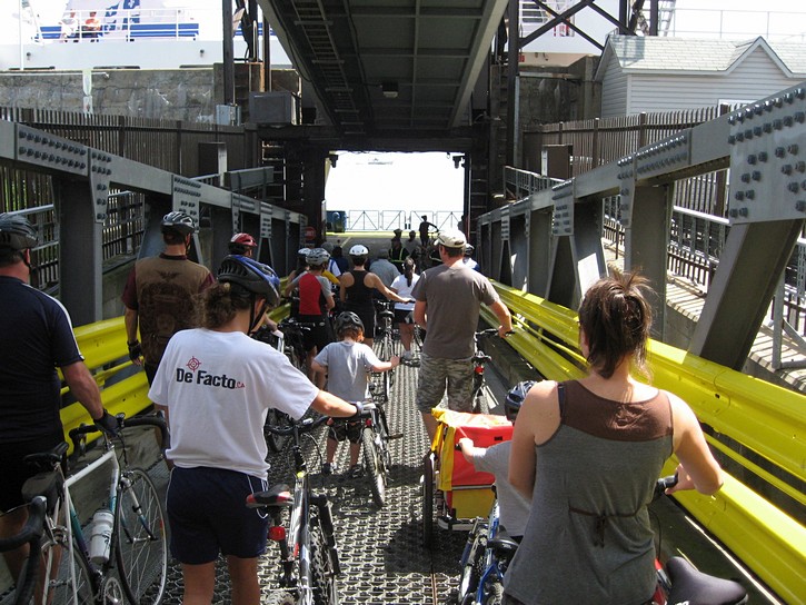
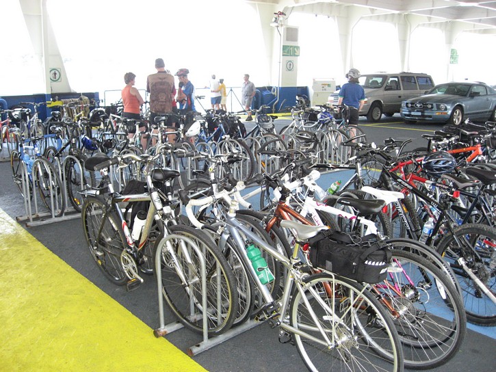
If you would like to extend your ride, or are looking for new areas to explore, cross the river to Levis and check out the bike path along the south shore of the St. Lawrence. Depending on your exact starting point and your return route, the distance for this ride should be 30 to 40 kilometres. To start off, follow the route described above to get to the lower town, and take the Quebec-Levis ferry. The river is fairly narrow in this area so the ferry crossing only takes about ten minutes.
The cost of taking this ferry is $3.00 for a cyclist and bike (as of 2009). This ferry offers service specifically for cyclists, including racks for 100 bikes, and an air compressor for anyone who needs to pump up their tires. On nice weekend afternoons, bicycles can outnumber cars 3 to 1 on the ferry. Service starts early in the morning and runs well past midnight, with departures approximately every 30 minutes. See the link below for more details.
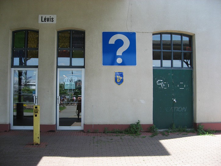
You’ll be on the bicycle path as soon you get off the ferry in Levis. As was the case on the north side of the river, this path is well indicated and has an excellent paved surface. Likewise, intersections with roads are kept to a minimum and in a number of areas the path has separate lanes for cyclists and pedestrians. Before you start pedaling, it should be noted that there are a couple of restaurants, public washrooms, and a tourist information office in the vicinity of the ferry terminal in Levis. If you don’t already have one, you should go into tourist office to get a map of bicycle paths in the region.
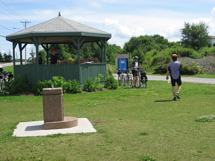
A gazebo at the end of the line
You can start this part of your ride by turning left and heading east. The path runs about 8 kilometres in this direction. Initially it follows the river’s shoreline, but later cuts inland through some residential areas. While you will encounter a few long slope on this part of the path, they are not very steep. Towards the end of the path you get a good view of the western tip of Île d’Orléans in the St. Lawrence. On a clear day, you’ll also be able to see the Montmorency Waterfalls in the distance across the river. At the end of the path there is a gazebo, a water fountain, and some outhouse toilets. You usually find a dozen or more cyclists hanging out here to rest, talk, and fill up their water bottles.
Needless to say, you can turn right and head west after getting off the ferry. You’ll soon get one of the best views of Quebec City from the south shore of the river. A little later on, you’ll notice that high bluffs on your left will start to resemble the cliffs on the opposite side of the river.
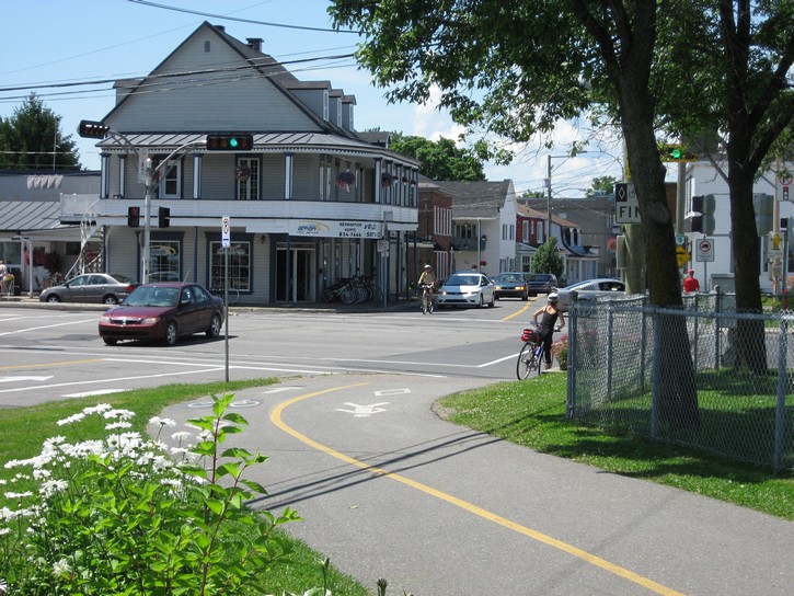
In about half a dozen kilometres, the path comes to an abrupt end at Genest Street. Fortunately, you can continue to push westward by turning right on Rue Genest. At the very next intersection (there’s a bicycle shop at the corner), Rue Genest becomes Chemin Du Fleuve. You simply ride on Chemin Du Fleuve for the next 4 or 5 kilometres. Although it does not have a shoulder or bike lane, it is nice quiet street that parallels the shoreline, and a pleasure to cycle on.
Cycling west towards the Quebec Bridge
The western end of Chemin Du Fleuve is fairly close to the Quebec Bridge, and here you find the beginning of a relatively large hill. It will now be decision time on how you plan to complete this ride. The easiest way will be to go back the way you came, and take the ferry to Quebec City. The other option is to cross the St. Lawrence River by cycling over the Quebec Bridge.
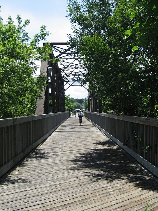
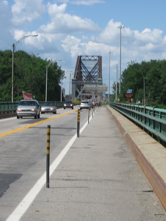
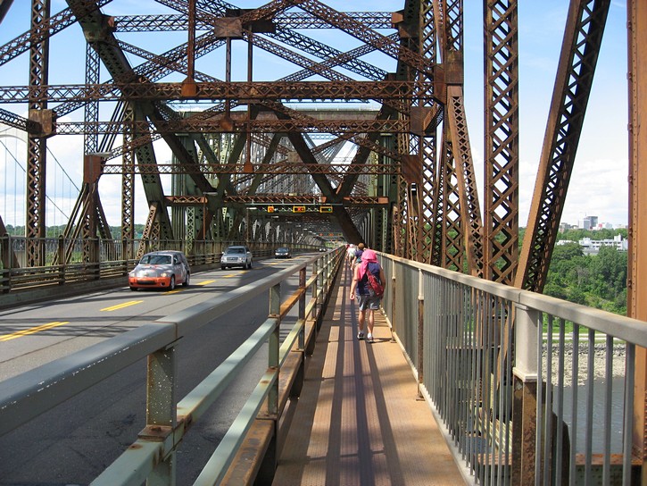
It should be pointed out that the Quebec Bridge is quite a famous structure. It was considered one of the wonders of the modern world when it was completed in 1918. It had the longest span in the world for a non-suspension bridge. Even today, it still holds the record for the bridge with the longest cantilever span. Needless to say, this was a very complicated bridge to build, as demonstrated by the fact that it collapsed twice during its construction.
Unfortunately, there are two problems with cycling across the Quebec Bridge. First, you have to contend with some hills when approaching the bridge, and again, shortly after getting off. An even bigger problem is that the bridge only has one very narrow walkway to accommodate pedestrians and cyclists travelling in both directions. Often one party has to stop and squeeze over to let the other through. Amazingly, local cyclists who are used to crossing this bridge manage to keep riding, even when passing each other (but they have no margin for error). With a little caution, riding across the bridge is do-able, and probably worth the effort.
Back across the river
If you do decide to cross the Quebec Bridge, climb the hills at end of Chemin Du Fleuve. Once at the top, you’ll have to take a route that swings quite a ways south before turning back towards the approach for the Quebec Bridge. There are signs indicating the proper route, but it is also a good idea to have a cycling map in you back pocket. Yes, the official map for the area actually indicates that the Quebec Bridge is a “designated” cycling route. (Note that bicycles are not allowed on the Pierre Laporte suspension bridge, which located right next to the Quebec Bridge.)
On the other side of the bridge the bicycle path will veer to the right and bring you to the “Avenue des Hôtels”. This road has a very basic bicycle lane. If you turn right on Avenue des Hôtels (heading towards the river), you will end up at the Quebec City Aquarium. It is a 40-acre facility with more than 10,000 fish specimens, and is suppose to be quite interesting. Unless you plan to go to the aquarium, you will turn left on Avenue des Hôtels. After climbing a bit of a hill, you will come to a major intersection where it is necessary to turn right onto Chemin St-Louis.
This part of Chemin St-Louis has a good bicycle lane. From here onwards, you simply head east on this road. In approximately ten blocks you’ll pass by Côte Ross Street and will be able to get back to your starting point by following the route described above for Ride #1.
Michael McGoldrick
August, 2009
![]()
![]()
![]()
![]()
![]()
![]()
(Click on the map for a larger version.)
(Click on the images for larger photos)