Upper Canada Village to Cornwall
Upper Canada Village to Cornwall
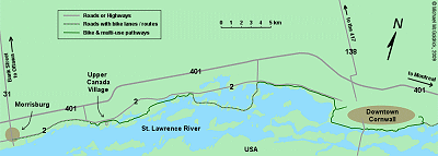
(Scroll down to the bottom the this page for map and photos.)
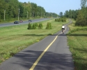
One of the nicest sections of Ontario’s Waterfront Trail can be found between Upper Canada Village and Cornwall. This 30 kilometre route will come as a surprise to cyclists who believe that there isn’t all that much of interest along the St-Lawrence River east of the Thousand Islands. Much of this route follows a paved multi-use pathway which winds its way through a migratory bird sanctuary, several waterfront parks, and even an open air museum. At one point it turns onto a parkway which passes through a series of islands which are connected by causeways.
Most of the route runs along the waterfront and is generally removed from any busy roads, except in the area near Cornwall, where the path does parallel some high traffic thoroughfares. It is also fairly flat, except, again, in the Cornwall area, where you will have to contend with a few long slopes. There are at least two places where you will be able to stop for a quick meal or buy a snack or something to drink.
The path between Upper Canada Village and Cornwall would be a very pleasant segment for anyone doing long distance bicycle touring along the Waterfront Trail in eastern Ontario. However, given that the area is a relatively short drive from the National Capital Region, it is also a good day-ride for Ottawa based cyclists looking for new places to explore. As a result, this article is written from the perspective of people who comes to the area by car, start their ride in the vicinity of Upper Canada Village, and head east towards Cornwall.
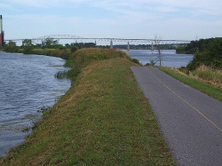
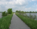
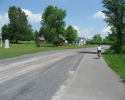
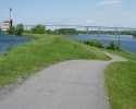
The approach to Cornwall. Note that the bridge in the background has been replaced by a low-level bridge. (scroll down for more photos)
There are any number of ways of driving to the area from Ottawa, but heading south on Highway 31 (Bank Street) is probably the most efficient. This will bring you right into Morrisburg, a village situated between Highway 2 and the St. Lawrence River. You could always find a place to park around Morrisburg and start your ride by heading east on Highway 2. From Morrisburg, it is about 12 kilometres to Upper Canada Village, or 43 kilometres to Cornwall.
Although there is a nice paved shoulder on Highway 2 between Morrisburg and the beginning of the multi-use path near Upper Canada Village, this part of the ride would not be overly interesting. You may therefore want to drive to Upper Canada Village and park on the left side of the Tourist Office. Needless to say, you may want to drop in this office to get a map and more information about the local area. They also rent bikes at this office (or at least did in 2008), but these are heavy cruiser-type bicycles.
Upper Canada Village
Once parked, you will discover that there are a number of attractions in the immediate area. Upper Canada Village is a representation of a 1860s village and has 40 heritage buildings, including mills, trades shops, farms, churches, homes, factories and a one-room schoolhouse. These old buildings were salvaged from the 6 villages and 3 hamlets that were flooded to make way for the St. Lawrence Seaway in the 1950s. In fact, as you proceed with your ride, you’ll soon see how the recent history of this entire area is dominated by the construction of the Seaway. The only problem with Upper Canada Village is that a worthwhile visit would probably take a couple of hours, and admission is little expensive (close to $20 for an adult as of 2009).
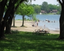
The Crysler Beach Day Use Park is located about half a kilometre west of Upper Canada Village . On a hot day its beach can come in quite handy, and the park has toilets and nice picnic areas. There is a fee to enter the park by car, but usually no charge for people arriving by bike.
And finally, it is worth noting that the surrounding area is the site of the Crysler’s Farm Battlefield, where a major engagement took place during the War of 1812. Although vastly out numbered, British and Canadian regulars along with a small militia unit and a group of Mohawk warriors were able to defeat an American invasion force that had crossed the St. Lawrence with plans to take Montreal.
Starting your ride
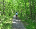
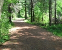
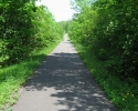
To start your ride, head east on the road behind the Tourist Information Office. Initially, there are signs indicating that access is restricted to vehicles that service Upper Canada Village, but you will be on the road that bicycles use to get the multi-use recreational pathway. In a little under a kilometre, you will see the beginnings of a trail made of hard packed crushed stone, or just plain hard packed earth. It is easy to ride on, even for bikes with narrow road tires. This is the only part of the route where you will not be cycling on an asphalt surface.
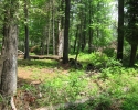
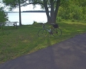
Although a little a narrower than normal, this part of the trail is really quite pleasant to ride on. It often runs along the water’s edge, and other parts wind their through a heavily forested area where you will sometime be riding on a wall to wall carpet of red pine needles. Not only is this visually impressive, but the pine needles emit a very agreeable aroma.
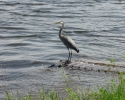
In about 5 to 6 kilometres you come to the 9,000 hectares Upper Canada Migratory Bird Sanctuary, where it is possible to see close to 200 bird species. Here you will find an interpretive centre and an elevated observation platform which you will be able to climb to get a good view of the surrounding landscape. There is also a parking lot for people arriving in this area by car on Morrison’s Road. The path through the sanctuary is reasonably wide, has a good paved surface, and provides a front row seat to the area’s habitat for a variety of plants and animals. At one point there are wetlands on both sides of the path, and it doesn’t take much looking to spot plenty of wildlife.
As you emerge from the bird sanctuary, you will find yourself riding through a recreation park setting to the St. Lawrence River. You soon pass by one of the many campgrounds in this area, and you often be able to see Highway 2 in the distance on your left. The path eventually leads to the gatehouse for the Long Sault Parkway. If you are getting hungry and want to buy a cold drink, you should note that it’s a short hop from this point to the town of Ingleside on Highway 2.
The Long Sault Parkway
The next part of the route will bring you onto the Long Sault Parkway, which definitely has to rate as one of the more interesting legs of the ride between Upper Canada Village and Cornwall. There is a fee for cars to use the Parkway, but its free for people arriving by bicycle (as of 2008). For this part of the ride, there is no dedicated recreational path, and you will be sharing the Parkway with cars (and there are no paved shoulders). However, this shouldn’t be of problem because, by its very nature, there isn’t very much traffic on this road. The main shortcoming with the Parkway is that in some areas there are significant cracks in the pavement which run across the entire width of the road. These can be quite jarring for road bikes with narrow tires travelling over 20 km/h.
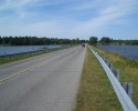
The Long Sault Parkway is close to 10 kilometres long and consists of a series of 11 islands that are connected by bridges or causeways. The islands are actually high points of land that remained after the St. Lawrence River flooded its banks when the Seaway was completed. You may also notice that this area is popular with scuba divers who like to explore what remains of towns and the ruins of an earlier canal that are now underwater. Although these 11 islands tend to look alike and are not as visually dramatic as the Thousand Islands, the Parkway is far more scenic than endless farm fields.
When you reach the gatehouse at the eastern end of the Parkway, you will again be close to Highway 2. This will be your second chance to grab a bite to eat or stock up on cool drinks as there is a Subway restaurant and a store a hundred metres towards the left on the highway. Otherwise, you continue by heading east on the recreational path. In this area, the path tends to run very close to the highway, although there is often a thin line of trees separating the two. Before long you come across the last major point of interest on this route. Here you will find yourself riding right through the “Lost Villages” open air museum.
The Lost Villages Museum
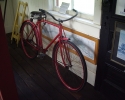
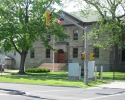
The Lost Villages Museum can best be described as a mini Upper Canada Village, and it consists of ten heritage buildings, including an old schoolhouse, a general store, and a barber shop. As was the case with Upper Canada Village, these buildings came from the towns that were flooded as a result of the construction of the Seaway. You can actually buy some snacks at the old general store, and can even find an old bicycle or two in the exhibits in some of the buildings. It’s well worth a visit. The museum is free, although donations are much appreciated.
You’ll be at the outskirts of Cornwall when you see the rather large sign for Guindon Park. This municipal park consists of approximately 500 acres and is over 2 kilometres long. This is also the are where you will encounter some of those long slopes. On this leg of your ride, the slopes are downhill, but obviously, you’ll have to pedal up on your way back. These slopes are not overly challenging, but may solicit the odd complaint from anyone who is really sensitive to hills.
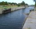
The path takes a right hand turn at Power Dam Road and heads towards the waterfront. At one point the layout of the path strongly suggests that you should cross Power Dam Road. Don’t. Stay to the right and the path will take you down to the waterfront. When you get there, on your right you will see a power generating station and one of the dams that caused all the flooding in the area. On your left, you will be able to continue on the path towards Cornwall. As your proceed, you will be riding on a strip of land between an old abandon canal and the St. Lawrence River, each with a different water level. The old canal is interesting because while it’s now in a state of total disrepair, it looks like they simply walked away from it when the Seaway opened over 50 years ago.
The path passes by the bridge the crosses St. Lawrence River, and soon afterwards you’ll end up riding through Cornwall’s waterfront park. Cornwall’s downtown core is centred around Pitt Street, which runs in a north/south direction, and ends at the clock tower in the waterfront park. Cornwall is a city of approximately 50,000 people, so you should be able to find whatever service you may need.
A day ride to Cornwall and back will be a little over 60 kilometres when departing from Upper Canada Village, and approximately 85 kilometres when using Morrisburg as a starting point.
A Word About the Waterfront Trail
The route described above is clearly part of Ontario’s Waterfront Trail which runs along the north shores of Lake Ontario and the St. Lawrence River. The Waterfront Trail stretches from Niagara-on-the-Lake to the Quebec/Ontario border, and covers a distance of approximately 900 kilometres. This trail is suppose to be made up of recreational paths, bicycle lanes, paved shoulders along existing roads, or quiet streets with little traffic. However, the Waterfront Trail is still very much a work-in-progress.
There are many areas the Waterfront Trail that can be used for enjoyable and relaxing rides. This is clearly the case with segments around Kingston, the section which follows the Thousand Island Parkway, and the part described in this article between Upper Canada Village and Cornwall. There are other areas of the trail where people have to ride on some fairly busy roads, but still have the benefit of a good paved shoulder. And then there are those sections where the trail exists in name only, and cyclists are forced to ride on secondary highways or other roads with lots of traffic that have no paved shoulder. Unfortunately, in eastern Ontario, there are a few such gaps in the trail between Morrisburg and Brockville.
Despite its shortcomings, it is worth checking out the Waterfront Trail web site when planning a ride anywhere along the St. Lawrence or Lake Ontario (see the link below). The web site includes a series of highly detailed maps which show the route for the entire trail. However, these maps can be a little confusing about the nature of the trail in certain areas. You will therefore have to be careful when interpreting them because you could inadvertently end up on one of those busy roads with no paved shoulder.
Another reason to check out the web site is to see the progress that is being made with the Waterfront Trail. Every year the province or municipalities make enhancements and additions to the trail, and sometimes improvements are realized simply by finding alternate routing. Although it may take another decade before the trail can be considered completed, there is enough in place today to rate the Waterfront Trail as a major cycling resource in Ontario.
Michael McGoldrick,
September, 2008
[feather_share]
Some handy links for this ride:
► Upper Canada Village |

